Area Overview for CV9 2PJ
Photos of CV9 2PJ
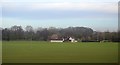

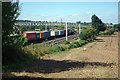
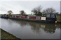
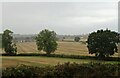
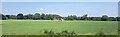
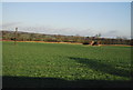
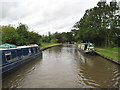
30 photos from this area
Area Information
Key information about the CV9 2PJ including its size, population, and administrative classification.
- Area Type
- Postcode
- Area Size
- 13.1 hectares
- Population
- 1717
- Population Density
- 188 people/km²
House Prices in CV9 2PJ
46
Properties
£192,796
Average Sold Price
£60,000
Lowest Price
£442,500
Highest Price
Showing 46 properties
| Address | Type | Beds | Baths | Last Sale Price | Last Sale Date | |
|---|---|---|---|---|---|---|
| 225 Watling Street, Grendon, CV9 2PJ | Detached | 5 | 3 | £442,500 | Mar 2025 | |
| 191 Watling Street, Grendon, CV9 2PJ | Detached | 4 | 1 | £270,000 | Jan 2024 | |
| 267 Watling Street, Grendon, CV9 2PJ | Detached | 4 | - | £425,000 | May 2022 | |
| 255 Watling Street, Grendon, CV9 2PJ | Terraced | 3 | 1 | £186,000 | Apr 2022 | |
| 257 Watling Street, Grendon, CV9 2PJ | house | - | - | £192,500 | Feb 2022 | |
| 213 Watling Street, Grendon, CV9 2PJ | house | - | - | £362,500 | Dec 2021 | |
| 259 Watling Street, Grendon, CV9 2PJ | house | - | - | £188,000 | Aug 2021 | |
| 237 Watling Street, Grendon, CV9 2PJ | Semi-detached | 2 | 1 | £200,000 | Jun 2021 | |
| 261 Watling Street, Grendon, CV9 2PJ | house | - | - | £175,000 | Mar 2021 | |
| 207 Watling Street, Grendon, CV9 2PJ | house | - | - | £264,000 | Mar 2020 |
Page 1 of 5
Energy Efficiency in CV9 2PJ
Amenities
Schools
| Rank | School | Type | Entry gender | Ages |
|---|
Explore more schools in this area
Go to Schools tabDemographics
Household Size
Family (3-5 people)
most common
Accommodation Type
Houses
most common
Tenure
84
majority
Ethnic Group
White
most common
Religion
N/A
most common
Household Composition
N/A
most common
Age
47
median
Adults (30-64 years)
most common
Household Deprivation
N/A
with no deprivation
NS-SEC
35
in Lower managerial occupations
Explore more demographic insights in this area
Go to Demographics tabPlanning
Planning Constraints
- Flood RiskPremium
- Ramsar Wetland SitesPremium
- Area of Outstanding Natural BeautyPremium
- Protected Nature ReservePremium
- Protected WoodlandPremium