Area Overview for CV9 2EX
Photos of CV9 2EX
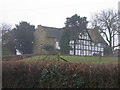
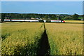
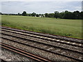
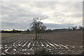
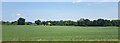
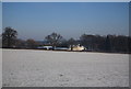
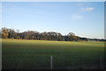
16 photos from this area
Area Information
Key information about the CV9 2EX including its size, population, and administrative classification.
- Area Type
- Postcode
- Area Size
- 1.0 km²
- Population
- 1662
- Population Density
- 207 people/km²
House Prices in CV9 2EX
17
Properties
£405,714
Average Sold Price
£200,000
Lowest Price
£720,000
Highest Price
Showing 17 properties
| Address | Type | Beds | Baths | Last Sale Price | Last Sale Date | |
|---|---|---|---|---|---|---|
| Byeways, Spon Lane, Grendon, CV9 2EX | house | - | - | £720,000 | Jun 2023 | |
| Glendevon, Spon Lane, Grendon, CV9 2EX | house | 3 | - | £400,000 | Jun 2021 | |
| Acres End, Spon Lane, Grendon, CV9 2EX | Detached | 4 | 2 | £590,000 | Jun 2021 | |
| Brookside, Spon Lane, Grendon, CV9 2EX | Detached | 4 | 1 | £330,000 | Jul 2018 | |
| Field Brook Farm, Spon Lane, Grendon, CV9 2EX | Detached | 4 | - | £350,000 | Jun 2018 | |
| Manor House Farm Bungalow, Spon Lane, Grendon, CV9 2EX | Bungalow | 2 | - | £200,000 | Jun 2011 | |
| Hall Raggin, Spon Lane, Grendon, CV9 2EX | Detached | - | - | £250,000 | Dec 2008 | |
| Green Acres, Spon Lane, Grendon, CV9 2EX | house | - | - | - | - | |
| Dairy House Farm, Spon Lane, Grendon, CV9 2EX | Detached | - | - | - | - | |
| Mobile Home, Thompsons Meadow, Spon Lane, Grendon, CV9 2EX | Mobile Home | - | - | - | - |
Page 1 of 2
Energy Efficiency in CV9 2EX
Amenities
Schools
| Rank | School | Type | Entry gender | Ages |
|---|
Explore more schools in this area
Go to Schools tabDemographics
Household Size
Two person
most common
Accommodation Type
Houses
most common
Tenure
63
majority
Ethnic Group
White
most common
Religion
N/A
most common
Household Composition
N/A
most common
Age
47
median
Adults (30-64 years)
most common
Household Deprivation
N/A
with no deprivation
NS-SEC
25
in Lower managerial occupations
Explore more demographic insights in this area
Go to Demographics tabPlanning
Planning Constraints
- Flood RiskPremium
- Ramsar Wetland SitesPremium
- Area of Outstanding Natural BeautyPremium
- Protected Nature ReservePremium
- Protected WoodlandPremium