Area Overview for CV9 2AW
Photos of CV9 2AW
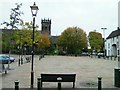
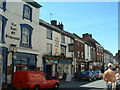
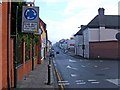
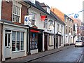

100 photos from this area
Area Information
Key information about the CV9 2AW including its size, population, and administrative classification.
- Area Type
- Postcode
- Area Size
- 10.2 hectares
- Population
- 1116
- Population Density
- 71 people/km²
House Prices in CV9 2AW
45
Properties
£119,375
Average Sold Price
£25,000
Lowest Price
£249,950
Highest Price
Showing 45 properties
| Address | Type | Beds | Baths | Last Sale Price | Last Sale Date | |
|---|---|---|---|---|---|---|
| 66 Stratford Avenue, Atherstone, CV9 2AW | Semi-detached | 3 | 1 | £180,000 | Dec 2023 | |
| 34 Stratford Avenue, Atherstone, CV9 2AW | Semi-detached | 3 | 1 | £249,950 | Oct 2023 | |
| 84 Stratford Avenue, Atherstone, CV9 2AW | house | - | - | £158,000 | Jul 2021 | |
| 46 Stratford Avenue, Atherstone, CV9 2AW | Semi-detached | 3 | 1 | £175,000 | Mar 2020 | |
| 30A Stratford Avenue, Atherstone, CV9 2AW | Semi-detached | 3 | 1 | £151,250 | May 2017 | |
| 82 Stratford Avenue, Atherstone, CV9 2AW | Semi-detached | 3 | 1 | £129,000 | Nov 2015 | |
| 28 Stratford Avenue, Atherstone, CV9 2AW | Semi-detached | 3 | - | £125,000 | Dec 2014 | |
| 20 Stratford Avenue, Atherstone, CV9 2AW | Semi-detached | 3 | - | £119,950 | Jan 2012 | |
| 24 Stratford Avenue, Atherstone, CV9 2AW | Semi-detached | - | - | £110,000 | May 2006 | |
| 4 Stratford Avenue, Atherstone, CV9 2AW | house | - | - | £118,950 | May 2006 |
Page 1 of 5
Energy Efficiency in CV9 2AW
Amenities
Schools
| Rank | School | Type | Entry gender | Ages |
|---|
Explore more schools in this area
Go to Schools tabDemographics
Household Size
Two person
most common
Accommodation Type
Houses
most common
Tenure
74
majority
Ethnic Group
White
most common
Religion
N/A
most common
Household Composition
N/A
most common
Age
47
median
Adults (30-64 years)
most common
Household Deprivation
N/A
with no deprivation
NS-SEC
31
in Lower managerial occupations
Explore more demographic insights in this area
Go to Demographics tabPlanning
Planning Constraints
- Flood RiskPremium
- Ramsar Wetland SitesPremium
- Area of Outstanding Natural BeautyPremium
- Protected Nature ReservePremium
- Protected WoodlandPremium