Area Overview for CV9 2AQ
Photos of CV9 2AQ
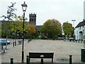
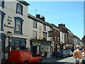
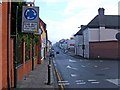
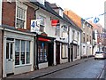

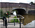
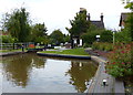
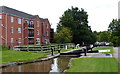
100 photos from this area
Area Information
Key information about the CV9 2AQ including its size, population, and administrative classification.
- Area Type
- Postcode
- Area Size
- 6654 m²
- Population
- 2189
- Population Density
- 2952 people/km²
House Prices in CV9 2AQ
11
Properties
£147,667
Average Sold Price
£88,000
Lowest Price
£255,000
Highest Price
Showing 11 properties
| Address | Type | Beds | Baths | Last Sale Price | Last Sale Date | |
|---|---|---|---|---|---|---|
| 178 Coleshill Road, Atherstone, CV9 2AQ | Semi-detached | 3 | 1 | £255,000 | Feb 2025 | |
| 168 Coleshill Road, Atherstone, CV9 2AQ | Terraced | 2 | 1 | £108,000 | Dec 2017 | |
| 170 Coleshill Road, Atherstone, CV9 2AQ | Terraced | 2 | 1 | £115,000 | Nov 2017 | |
| 180 Coleshill Road, Atherstone, CV9 2AQ | Bungalow | 2 | 1 | £215,000 | Dec 2013 | |
| 176 Coleshill Road, Atherstone, CV9 2AQ | house | 3 | - | £105,000 | Jan 2013 | |
| 182 Coleshill Road, Atherstone, CV9 2AQ | Detached | 3 | 1 | £88,000 | Nov 1999 | |
| 172 Coleshill Road, Atherstone, CV9 2AQ | Semi-detached | - | - | - | - | |
| 166 Coleshill Road, Atherstone, CV9 2AQ | Terraced | - | - | - | - | |
| Stratford House, 192 Coleshill Road, Atherstone, CV9 2AQ | Detached | - | - | - | - | |
| 190 Coleshill Road, Atherstone, CV9 2AQ | Detached | - | - | - | - |
Page 1 of 2
Energy Efficiency in CV9 2AQ
Amenities
Schools
| Rank | School | Type | Entry gender | Ages |
|---|
Explore more schools in this area
Go to Schools tabDemographics
Household Size
Two person
most common
Accommodation Type
Houses
most common
Tenure
61
majority
Ethnic Group
White
most common
Religion
N/A
most common
Household Composition
N/A
most common
Age
47
median
Adults (30-64 years)
most common
Household Deprivation
N/A
with no deprivation
NS-SEC
22
in Lower managerial occupations
Explore more demographic insights in this area
Go to Demographics tabPlanning
Planning Constraints
- Flood RiskPremium
- Ramsar Wetland SitesPremium
- Area of Outstanding Natural BeautyPremium
- Protected Nature ReservePremium
- Protected WoodlandPremium