Area Overview for CV9 1RJ
Photos of CV9 1RJ

Area Information
CV9 1RJ is a small residential postcode area in England, encompassing a compact cluster of homes within the village of Mancetter, North Warwickshire. The area spans 3,432 square metres and is home to 1,582 residents, giving it a population density of 294 people per square kilometre. Historically significant, Mancetter dates back to Roman times, with remnants of ancient earthworks and a 13th-century church still standing. Today, it sits near the A5 trunk road and the Coventry Canal, offering connections to nearby towns like Atherstone. The area’s character blends historical heritage with modern living, making it appealing to those seeking a quieter, community-focused lifestyle. With a median age of 47, the population skews towards adults in their middle years, suggesting a stable, family-oriented demographic. Proximity to rail stations and local amenities ensures practicality for daily life, while the absence of major planning constraints allows for straightforward development.
- Area Type
- Postcode
- Area Size
- 3432 m²
- Population
- 1582
- Population Density
- 294 people/km²
The property market in CV9 1RJ is characterised by a 39% home ownership rate, meaning the majority of properties are rented. This suggests a rental-focused market, which may appeal to those seeking flexibility or affordability. The predominant accommodation type is houses, which are typically larger and suited to families or individuals preferring more space. Given the area’s small size and limited population density, the housing stock is likely constrained, with limited scope for expansion. Buyers should consider that the market may have fewer options compared to larger towns, but the presence of houses could offer value for those prioritising space. The absence of major planning constraints, such as protected areas or nature reserves, may also make the area more accessible for development or investment.
House Prices in CV9 1RJ
No properties found in this postcode.
Energy Efficiency in CV9 1RJ
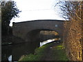
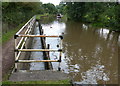
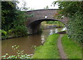
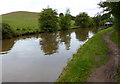
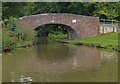
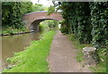
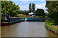
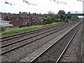
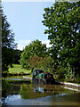
The lifestyle in CV9 1RJ is shaped by nearby amenities that cater to daily needs. Retail options include Co-op Long, Morrisons Daily, and Aldi Atherstone, providing access to groceries and essentials. The area’s rail connections to Atherstone, Nuneaton, and Polesworth offer convenience for travel, while the A5 road links to broader networks. The Coventry Canal, running through the parish, adds a historical and recreational element. The village’s heritage, including the 13th-century Church of St Peter and timber-framed Mancetter Manor, contributes to a distinct character. These amenities and historical sites create a blend of practicality and charm, supporting both local living and regional connectivity.
Amenities
Schools
The nearest school to CV9 1RJ is Wathen Grange School, a special school catering to students with specific educational needs. This indicates that the area is served by a facility tailored to particular requirements, though no mainstream primary or secondary schools are listed in the data. Families seeking a broader range of educational options may need to look beyond the immediate vicinity. The presence of a special school suggests the community may have a higher proportion of residents with children requiring specialist support. However, the lack of other schools in the data means prospective buyers should investigate further to ensure access to a full spectrum of educational services.
| Rank | School | Type | Entry gender | Ages |
|---|
Explore more schools in this area
Go to Schools tabDemographics
The population of CV9 1RJ has a median age of 47, with the most common age range being adults aged 30–64. This suggests a mature, established community with a focus on stability. Home ownership in the area stands at 39%, meaning 61% of properties are likely rented, indicating a mix of owner-occupied and rental housing. The predominant accommodation type is houses, which aligns with the area’s small, residential nature. The predominant ethnic group is White, reflecting a homogenous demographic. The age profile and home ownership figures suggest a community that is neither overly young nor transient, with residents likely prioritising long-term residency. However, the relatively low home ownership rate may indicate a reliance on rental markets or shared housing, which could affect the area’s social dynamics and property values.
Household Size
Accommodation Type
Tenure
Ethnic Group
Religion
Household Composition
Age
Household Deprivation
NS-SEC
Explore more demographic insights in this area
Go to Demographics tabPlanning
Planning Constraints
- Flood RiskPremium
- Ramsar Wetland SitesPremium
- Area of Outstanding Natural BeautyPremium
- Protected Nature ReservePremium
- Protected WoodlandPremium