Area Overview for CV9 1RB
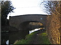
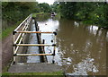
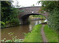
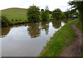
Photos of CV9 1RB
Area Information
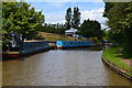
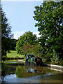
CV9 1RB is a small, compact postcode area in England, encompassing a residential cluster with a population of 1,582 people spread across 8,360 square metres. This translates to a population density of 294 people per square kilometre, suggesting a tight-knit, low-rise community. Situated in a historically significant region, the area is bordered by the A5 (Watling Street) and the Coventry Canal, linking it to broader transport networks. The village of Mancetter, where CV9 1RB is located, has roots in Roman times, with archaeological evidence of a posting station and fortress dating to the 1st century AD. Today, the area retains a quiet, rural character, with a median age of 47 and a predominantly White population. Daily life here is shaped by proximity to local amenities, including shops, rail stations, and historical sites. The area’s small size means residents are close to essential services, though its isolation from major cities may appeal to those seeking a slower pace of life. With a focus on houses rather than flats, CV9 1RB offers a traditional housing stock, ideal for those prioritising space and a sense of community.
- Area Type
- Postcode
- Area Size
- 8360 m²
- Population
- 1582
- Population Density
- 294 people/km²
The property market in CV9 1RB is characterised by a 39% home ownership rate, with houses making up the predominant accommodation type. This suggests a housing stock that is largely owner-occupied but with a significant proportion of rental properties. Given the small size of the area—8,360 square metres—and its compact nature, the number of available homes is limited, potentially creating a competitive market for buyers. The focus on houses rather than flats may appeal to those seeking larger living spaces, though the low ownership rate indicates that many properties are rented out. For prospective buyers, this dynamic implies that the area is not a hotbed for investment properties but rather a place where residents prioritise stability and space. The limited scale of the area means that buyers should consider nearby regions for additional options, though the immediate surroundings may offer a cohesive, traditional housing environment.
House Prices in CV9 1RB
No properties found in this postcode.
Energy Efficiency in CV9 1RB
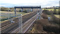
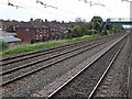
Residents of CV9 1RB have access to a modest selection of nearby amenities, including five retail outlets such as Co-op Long, Morrisons Daily, and Aldi Atherstone. These shops provide essential grocery and household services, reducing the need for long journeys to larger towns. The area’s proximity to rail stations enhances its connectivity, allowing residents to reach cultural, leisure, and professional hubs in nearby towns. While the data does not list parks or recreational facilities explicitly, the historical and natural features of Mancetter—such as Roman earthworks and the Coventry Canal—suggest opportunities for walking or heritage tourism. The presence of multiple rail stations and retail options contributes to a convenient, if limited, lifestyle, balancing local convenience with the need to travel for more specialised services.
Amenities
Schools
The nearest school to CV9 1RB is Wathen Grange School, a special school catering to students with specific educational needs. While the data does not provide Ofsted ratings, the presence of a special school suggests that the area may be part of a broader network of educational facilities serving both local and surrounding communities. Families in CV9 1RB may rely on this school for tailored support, though the absence of other schools in the immediate vicinity means that parents might need to consider commuting to nearby towns for additional educational options. The mix of school types is limited here, with only one institution listed, which could impact the diversity of educational choices available to residents.
| Rank | School | Type | Entry gender | Ages |
|---|
Explore more schools in this area
Go to Schools tabDemographics
The population of CV9 1RB has a median age of 47, with the most common age group being adults aged 30–64 years. This suggests a mature, stable community with a strong presence of working-age individuals and families. Home ownership in the area stands at 39%, which is lower than the national average, indicating a mix of owner-occupied and rented properties. The predominant accommodation type is houses, reflecting a preference for single-family homes over flats. The predominant ethnic group is White, with no data provided on other ethnicities or diversity levels. The age profile implies a community with established residents, though the absence of specific data on younger demographics or deprivation rates means the area’s inclusivity or challenges in these areas remain unquantified. For buyers, this demographic profile suggests a focus on long-term residency rather than transient populations, with a housing market skewed towards rental properties.
Household Size
Accommodation Type
Tenure
Ethnic Group
Religion
Household Composition
Age
Household Deprivation
NS-SEC
Explore more demographic insights in this area
Go to Demographics tabPlanning
Planning Constraints
- Flood RiskPremium
- Ramsar Wetland SitesPremium
- Area of Outstanding Natural BeautyPremium
- Protected Nature ReservePremium
- Protected WoodlandPremium