Area Overview for CV9 1PJ
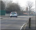
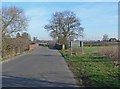
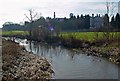
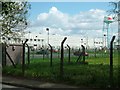
Photos of CV9 1PJ


Area Information
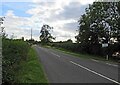
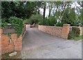
CV9 1PJ is a small, tightly knit residential area in north Warwickshire, nestled within the historic market town of Atherstone. Covering just 14.5 hectares, it is home to 1,509 residents, creating a densely populated yet compact community. The area’s population density of 1,309 people per square kilometre reflects its small-scale, residential character. Atherstone itself lies on the ancient Roman Watling Street, now the A5, and its history is woven into the town’s layout, with remnants of medieval trade and industry still visible. Living here means being part of a community with a median age of 47, where the majority of residents are adults aged 30–64. The area’s proximity to historic sites, such as the 12th-century St Mary’s Chapel and the restored 1847 railway station, adds a layer of cultural richness to everyday life. For those seeking a balance between tradition and modernity, CV9 1PJ offers a quiet, residential environment with easy access to nearby amenities and transport links.
- Area Type
- Postcode
- Area Size
- 14.5 hectares
- Population
- 1509
- Population Density
- 1309 people/km²
The property market in CV9 1PJ is dominated by owner-occupied homes, with 58% of residents owning their properties. This contrasts with areas where rental demand drives the market, indicating a focus on long-term residency rather than transient populations. The prevalence of houses over flats suggests a housing stock suited to families or individuals seeking more space. Given the area’s small size—just 14.5 hectares—housing options are limited, and competition for available properties may be keen. Buyers should consider the compact nature of the area and its immediate surroundings, where development is constrained by historical and environmental factors. The high home ownership rate also implies a stable market, with properties likely retaining value over time. However, the limited availability of new builds or larger estates may restrict choices for those seeking specific property types.
House Prices in CV9 1PJ
Showing 1 properties
| Address | Type | Beds | Baths | Last Sale Price | Last Sale Date | |
|---|---|---|---|---|---|---|
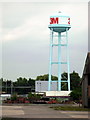
| 3 M Uk Ltd, Three M ( 3M ) (uk) Plc, Ratcliffe Road, Atherstone, CV9 1PJ | office_workshop | - | - | - | - |
Energy Efficiency in CV9 1PJ
Residents of CV9 1PJ enjoy a range of nearby amenities that support daily life. The area is served by five retail outlets, including Co-op Long, Morrisons Daily, and Aldi Atherstone, offering convenience for shopping and daily essentials. Rail connectivity is extensive, with four stations—Atherstone, Polesworth, Nuneaton, and Shenton—providing links to broader regional networks. The historic character of Atherstone adds to the area’s appeal, with landmarks such as the 12th-century St Mary’s Chapel and the restored 1847 railway station. While the data does not mention parks or leisure facilities explicitly, the town’s heritage and proximity to the A5 suggest opportunities for walking, cycling, and exploring local history. The mix of retail, transport, and cultural assets creates a lifestyle that balances practicality with a touch of tradition.
Amenities
Schools
Residents of CV9 1PJ have access to several primary schools within close proximity, including Racemeadow Primary School, Atherstone North County Middle School, Racemeadow First School, and Racemeadow Primary Academy. The latter holds an Ofsted rating of ‘good’, reflecting its quality of education. The concentration of primary schools in the area is particularly beneficial for families with young children, offering multiple options for early education. The presence of four primary schools within a short distance suggests a well-served educational infrastructure for younger residents. However, no secondary schools are listed in the data, meaning families may need to look further afield for secondary education. The mix of school types ensures flexibility, though parents should verify the specific catchment areas and transport links to each institution.
| Rank | School | Type | Entry gender | Ages |
|---|
Explore more schools in this area
Go to Schools tabDemographics
The population of CV9 1PJ is predominantly composed of adults aged 30–64, with a median age of 47. This suggests a mature, stable community with a strong presence of established households. Home ownership is relatively high at 58%, indicating a mix of long-term residents and those invested in property. The area is characterised by houses rather than flats, reflecting a suburban or semi-rural housing stock. The predominant ethnic group is White, aligning with broader trends in the region. The population density of 1,309 people per square kilometre implies a close-knit community where social interactions are likely frequent. While no specific deprivation data is provided, the high home ownership and age profile suggest a relatively stable economic environment. However, the absence of detailed diversity metrics means the full range of community dynamics remains unexplored.
Household Size
Accommodation Type
Tenure
Ethnic Group
Religion
Household Composition
Age
Household Deprivation
NS-SEC
Explore more demographic insights in this area
Go to Demographics tabPlanning
Planning Constraints
- Flood RiskPremium
- Ramsar Wetland SitesPremium
- Area of Outstanding Natural BeautyPremium
- Protected Nature ReservePremium
- Protected WoodlandPremium