Area Overview for CV9 1AA
Photos of CV9 1AA

Area Information
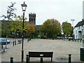
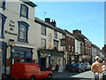
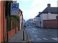
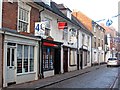
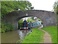
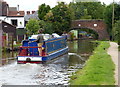
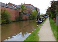
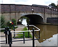
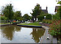
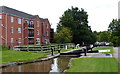
CV9 1AA is a small residential postcode area in north Warwickshire, encompassing parts of the historic market town of Atherstone. With a population of 1,981 spread across 2,928 square metres, it is densely populated yet retains a compact, community-focused character. Situated on the ancient Roman Watling Street (modern A5), the area is steeped in history, with ties to Anglo-Saxon settlements and medieval trade routes. Daily life here is shaped by its proximity to Atherstone’s historic core, where features like St Mary’s Chapel and the restored 1847 railway station building add charm. The area’s small size means residents are close to local amenities, schools, and transport links, while its location on major roads and rail lines offers connectivity to nearby towns like Nuneaton and Coventry. The mix of historic architecture and modern infrastructure creates a unique blend of tradition and practicality, appealing to those seeking a settled, accessible lifestyle in a place with a rich heritage.
- Area Type
- Postcode
- Area Size
- 2928 m²
- Population
- 1981
- Population Density
- 5863 people/km²
The property market in CV9 1AA is characterised by a low home ownership rate of 26%, suggesting that a significant portion of the housing stock is rented out or owned by investors. The predominant accommodation type is houses, which may indicate a mix of older, family-oriented homes and newer developments. Given the area’s small size and high population density, the housing stock is likely limited, with competition for available properties. This could make the area attractive to buyers seeking a stable, established neighbourhood with a strong sense of community, though the low ownership rate might also reflect affordability challenges or a reliance on rental markets. Prospective buyers should consider the compact nature of the area and its proximity to essential services when evaluating properties.
House Prices in CV9 1AA
Showing 1 properties
| Address | Type | Beds | Baths | Last Sale Price | Last Sale Date | |
|---|---|---|---|---|---|---|
| Atherstone Delivery Office, 7 Coleshill Street, Atherstone, CV9 1AA | warehouse | - | - | - | - |
Energy Efficiency in CV9 1AA
Residents of CV9 1AA benefit from a range of nearby amenities, including five retail outlets such as Co-op Long, Morrisons Daily, and Aldi Atherstone, ensuring everyday shopping needs are met. The area’s rail connectivity to Atherstone, Polesworth, and Nuneaton stations provides easy access to broader regional networks. Historically, the town’s Long Street features Victorian and Georgian architecture, adding character to daily life. While parks and leisure facilities are not explicitly listed, the proximity to Atherstone’s historic sites and the town’s traditional layout suggest a mix of practical amenities and cultural heritage. The compact nature of the area means residents can access shops, transport, and local services without long commutes, fostering a convenient, community-oriented lifestyle.
Amenities
Schools
Residents of CV9 1AA have access to three distinct educational institutions. Atherstone Grammar School, listed as an “other” type, serves as a traditional secondary school. OneSchool Global UK is an independent institution, offering alternative educational approaches, while Independent Educational Services is a special school catering to specific learning needs. The presence of both independent and special schools provides families with options tailored to different educational preferences and requirements. However, the absence of primary schools in the immediate area may necessitate commuting for younger children. The mix of school types reflects a diverse educational landscape, though parents should assess the suitability of each institution based on their child’s needs and the school’s performance.
| Rank | School | Type | Entry gender | Ages |
|---|
Explore more schools in this area
Go to Schools tabDemographics
The population of CV9 1AA has a median age of 47, with the majority of residents falling within the 30–64 age range. This suggests a mature, established community, likely with strong ties to local employment and long-term residency. Home ownership is relatively low at 26%, indicating a higher proportion of rental properties or shared ownership models. The predominant accommodation type is houses, reflecting a preference for single-family dwellings over flats. The ethnic composition is largely White, with no specific data on other groups provided. The high population density of 676,568 people per square kilometre highlights a compact, possibly urbanised living environment. While this density may offer convenience, it also underscores the need for efficient local services and infrastructure to support the community’s needs.
Household Size
Accommodation Type
Tenure
Ethnic Group
Religion
Household Composition
Age
Household Deprivation
NS-SEC
Explore more demographic insights in this area
Go to Demographics tabPlanning
Planning Constraints
- Flood RiskPremium
- Ramsar Wetland SitesPremium
- Area of Outstanding Natural BeautyPremium
- Protected Nature ReservePremium
- Protected WoodlandPremium