Area Overview for CV6 7FF
Photos of CV6 7FF

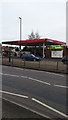
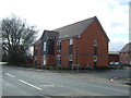
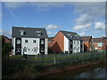
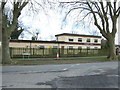

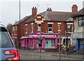
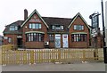
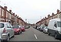
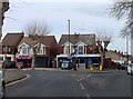

95 photos from this area
Area Information
Key information about the CV6 7FF including its size, population, and administrative classification.
- Area Type
- Postcode
- Area Size
- 3832 m²
- Population
- 2093
- Population Density
- 5411 people/km²
House Prices in CV6 7FF
20
Properties
£102,269
Average Sold Price
£35,000
Lowest Price
£200,000
Highest Price
Showing 20 properties
| Address | Type | Beds | Baths | Last Sale Price | Last Sale Date | |
|---|---|---|---|---|---|---|
| 35 Mason Road, Coventry, CV6 7FF | Terraced | 3 | 1 | £200,000 | Aug 2025 | |
| 1A Mason Road, Coventry, CV6 7FF | house | - | - | £180,000 | Nov 2020 | |
| 1 Mason Road, Coventry, CV6 7FF | Terraced | 2 | 2 | £105,000 | Nov 2018 | |
| 21 Mason Road, Coventry, CV6 7FF | house | 3 | - | £107,000 | Dec 2015 | |
| 17 Mason Road, Coventry, CV6 7FF | house | - | - | £85,000 | Feb 2012 | |
| 15 Mason Road, Coventry, CV6 7FF | house | - | - | £80,000 | Apr 2009 | |
| 31 Mason Road, Coventry, CV6 7FF | house | - | - | £128,000 | Nov 2007 | |
| 19 Mason Road, Coventry, CV6 7FF | house | - | - | £110,000 | May 2007 | |
| 25 Mason Road, Coventry, CV6 7FF | house | - | - | £81,000 | Oct 2006 | |
| 13 Mason Road, Coventry, CV6 7FF | Terraced | - | - | £45,000 | Feb 2006 |
Page 1 of 2
Energy Efficiency in CV6 7FF
Amenities
Schools
| Rank | School | Type | Entry gender | Ages |
|---|
Explore more schools in this area
Go to Schools tabDemographics
Household Size
Family (3-5 people)
most common
Accommodation Type
Houses
most common
Tenure
45
majority
Ethnic Group
White
most common
Religion
N/A
most common
Household Composition
N/A
most common
Age
47
median
Adults (30-64 years)
most common
Household Deprivation
N/A
with no deprivation
NS-SEC
16
in Lower managerial occupations
Explore more demographic insights in this area
Go to Demographics tabPlanning
Planning Constraints
- Flood RiskPremium
- Ramsar Wetland SitesPremium
- Area of Outstanding Natural BeautyPremium
- Protected Nature ReservePremium
- Protected WoodlandPremium