Area Overview for CV6 5RF
Photos of CV6 5RF

Area Information
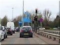
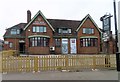
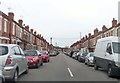
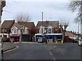
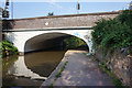
CV6 5RF is a compact residential postcode nestled in the northern reaches of Coventry, within the Foleshill Ward. Its 1.2-hectare footprint accommodates 1,723 residents, creating a densely populated yet intimate community. The area’s history is steeped in industrial legacy, once a rural parish mentioned in the Domesday Book and later shaped by 18th-century ribbon weaving, canals, and railways. Today, it blends urban living with remnants of its past, such as St Laurence’s Church and former factory sites repurposed as housing. The neighbourhood’s character is defined by its proximity to Foleshill Road (A444), a key arterial route, and its integration into Coventry’s broader infrastructure. With a median age of 47 and a majority of residents aged 30–64, the community is stable and family-oriented, though the 37% home ownership rate suggests a significant rental market. Living here means navigating a mix of practical amenities, from local shops to rail links, while navigating the challenges of a historically industrialised area with a diverse population.
- Area Type
- Postcode
- Area Size
- 1.2 hectares
- Population
- Not available
- Population Density
- Not available
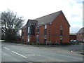
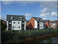
The property market in CV6 5RF is characterised by a low home ownership rate of 37%, suggesting that the area is more rental-focused than owner-occupied. The predominant accommodation type is houses, which may appeal to families seeking more space in a densely populated setting. However, the small area size of 1.2 hectares limits the availability of housing stock, potentially driving competition for available properties. This compactness means buyers must consider proximity to amenities and transport links, as the immediate surroundings are crucial for access to services. The presence of nearby rail stations and retail hubs may offset the area’s limitations, but the low home ownership rate indicates that investment in property here could be speculative, depending on market trends and local demand.
House Prices in CV6 5RF
Showing 1 properties
| Address | Type | Beds | Baths | Last Sale Price | Last Sale Date | |
|---|---|---|---|---|---|---|
| 648 Foleshill Road, Coventry, CV6 5RF | undefined | - | - | - | - |
Energy Efficiency in CV6 5RF
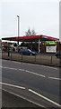
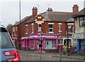
The lifestyle in CV6 5RF is shaped by its proximity to practical amenities. Residents have access to five retail outlets, including Lidl Edgwick, Morrisons Daily, and Aldi Edgwick, providing everyday shopping convenience. The area’s rail stations, such as Coventry Arena and Bedworth, offer direct links to leisure and employment opportunities in Coventry and surrounding regions. While the data does not specify parks or recreational facilities, the area’s industrial heritage suggests a utilitarian character, with former factory sites now serving as housing or commercial spaces. The mix of retail, transport, and nearby airports ensures a functional daily life, though the absence of detailed information on green spaces or leisure venues may require further exploration for those prioritising outdoor activities.
Amenities
Schools
Residents of CV6 5RF have access to two primary schools within practical reach. Edgewick Community Primary School is a state-funded institution with a ‘good’ Ofsted rating, offering a public education option for families. Nearby, Lote Tree Primary School is an independent school also rated ‘good’ by Ofsted, providing an alternative for those seeking private education. The coexistence of both state and independent schools creates a diverse educational landscape, allowing parents to choose between public and private schooling based on their priorities. Both institutions are likely to be well-regarded within the community, though the specific curriculum and resources available would depend on their individual policies. The proximity of these schools to the area underscores its appeal for families prioritising quality education.
| Rank | School | Type | Entry gender | Ages |
|---|
Explore more schools in this area
Go to Schools tabDemographics
The population of CV6 5RF is predominantly adults aged 30–64, with a median age of 47. This suggests a mature, established community with a strong presence of working-age residents. Home ownership is relatively low at 37%, indicating that a majority of households are likely renting, which may influence the area’s rental market dynamics. The accommodation type is primarily houses, which contrasts with the higher proportion of flats in other urban areas. The predominant ethnic group is the Asian community, reflecting the post-World War II migration patterns that shaped Coventry’s demographics. This diversity contributes to a culturally rich environment, though it also means the area may have distinct social and economic characteristics compared to more homogenous neighbourhoods. The high population density of 144,470 people per square kilometre underscores the compact nature of the area, which could affect local services and community interactions.
Household Size
Accommodation Type
Tenure
Ethnic Group
Religion
Household Composition
Age
Household Deprivation
NS-SEC
Explore more demographic insights in this area
Go to Demographics tabPlanning
Planning Constraints
- Flood RiskPremium
- Ramsar Wetland SitesPremium
- Area of Outstanding Natural BeautyPremium
- Protected Nature ReservePremium
- Protected WoodlandPremium