Area Overview for CV6 5FR
Photos of CV6 5FR
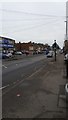
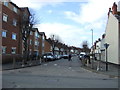
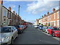
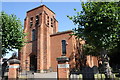

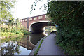
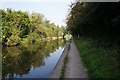
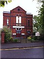
92 photos from this area
Area Information
Key information about the CV6 5FR including its size, population, and administrative classification.
- Area Type
- Postcode
- Area Size
- 7398 m²
- Population
- 1590
- Population Density
- 9148 people/km²
House Prices in CV6 5FR
34
Properties
£104,972
Average Sold Price
£16,800
Lowest Price
£175,000
Highest Price
Showing 34 properties
| Address | Type | Beds | Baths | Last Sale Price | Last Sale Date | |
|---|---|---|---|---|---|---|
| 161 Station Street East, Coventry, CV6 5FR | house | - | - | £85,000 | Jan 2024 | |
| 170 Station Street East, Coventry, CV6 5FR | Terraced | 3 | 1 | £165,000 | Nov 2023 | |
| 164 Station Street East, Coventry, CV6 5FR | Terraced | 3 | 1 | £167,000 | Mar 2022 | |
| 155 Station Street East, Coventry, CV6 5FR | house | 5 | 2 | £175,000 | Feb 2021 | |
| 165 Station Street East, Coventry, CV6 5FR | Terraced | 2 | 1 | £117,000 | Jul 2020 | |
| 180 Station Street East, Coventry, CV6 5FR | Semi-detached | 2 | 1 | £97,000 | Oct 2019 | |
| 147 Station Street East, Coventry, CV6 5FR | Terraced | 4 | 2 | £140,000 | May 2018 | |
| 178 Station Street East, Coventry, CV6 5FR | Terraced | 3 | - | £120,000 | Jun 2016 | |
| 176 Station Street East, Coventry, CV6 5FR | Terraced | 3 | - | £90,500 | Apr 2014 | |
| 166 Station Street East, Coventry, CV6 5FR | house | - | - | £96,000 | May 2010 |
Page 1 of 4
Energy Efficiency in CV6 5FR
Amenities
Schools
| Rank | School | Type | Entry gender | Ages |
|---|
Explore more schools in this area
Go to Schools tabDemographics
Household Size
One person
most common
Accommodation Type
Houses
most common
Tenure
23
majority
Ethnic Group
White
most common
Religion
N/A
most common
Household Composition
N/A
most common
Age
47
median
Adults (30-64 years)
most common
Household Deprivation
N/A
with no deprivation
NS-SEC
10
in Lower managerial occupations
Explore more demographic insights in this area
Go to Demographics tabPlanning
Planning Constraints
- Flood RiskPremium
- Ramsar Wetland SitesPremium
- Area of Outstanding Natural BeautyPremium
- Protected Nature ReservePremium
- Protected WoodlandPremium