Area Overview for CV6 5BU
Photos of CV6 5BU
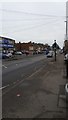
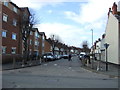
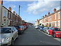
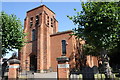

92 photos from this area
Area Information
Key information about the CV6 5BU including its size, population, and administrative classification.
- Area Type
- Postcode
- Area Size
- 9938 m²
- Population
- 1360
- Population Density
- 5329 people/km²
House Prices in CV6 5BU
52
Properties
£85,548
Average Sold Price
£12,000
Lowest Price
£190,000
Highest Price
Showing 52 properties
| Address | Type | Beds | Baths | Last Sale Price | Last Sale Date | |
|---|---|---|---|---|---|---|
| 36 Princess Street, Coventry, CV6 5BU | Terraced | 3 | 2 | £190,000 | Jul 2025 | |
| 74 Princess Street, Coventry, CV6 5BU | Terraced | 3 | 2 | £172,000 | Oct 2024 | |
| 34 Princess Street, Coventry, CV6 5BU | Terraced | 3 | 1 | £135,000 | Sep 2021 | |
| 40 Princess Street, Coventry, CV6 5BU | house | - | - | £155,000 | Jun 2021 | |
| 86 Princess Street, Coventry, CV6 5BU | house | - | - | £130,000 | Jun 2021 | |
| 66 Princess Street, Coventry, CV6 5BU | Terraced | - | - | £110,000 | Sep 2018 | |
| 114 Princess Street, Coventry, CV6 5BU | Terraced | 2 | 1 | £113,000 | Jul 2018 | |
| 28 Princess Street, Coventry, CV6 5BU | Terraced | 3 | 1 | £118,000 | Mar 2018 | |
| 32 Princess Street, Coventry, CV6 5BU | house | - | - | £90,000 | Jun 2017 | |
| 50 Princess Street, Coventry, CV6 5BU | Terraced | 3 | - | £103,000 | Dec 2014 |
Page 1 of 6
Energy Efficiency in CV6 5BU
Amenities
Schools
| Rank | School | Type | Entry gender | Ages |
|---|
Explore more schools in this area
Go to Schools tabDemographics
Household Size
Family (3-5 people)
most common
Accommodation Type
Houses
most common
Tenure
32
majority
Ethnic Group
White
most common
Religion
N/A
most common
Household Composition
N/A
most common
Age
47
median
Adults (30-64 years)
most common
Household Deprivation
N/A
with no deprivation
NS-SEC
15
in Lower managerial occupations
Explore more demographic insights in this area
Go to Demographics tabPlanning
Planning Constraints
- Flood RiskPremium
- Ramsar Wetland SitesPremium
- Area of Outstanding Natural BeautyPremium
- Protected Nature ReservePremium
- Protected WoodlandPremium