Area Overview for CV6 3HZ
Photos of CV6 3HZ
Area Information
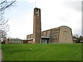
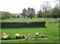
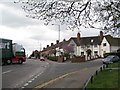
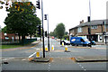
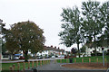
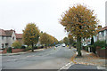
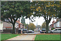
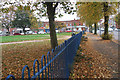
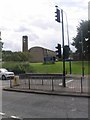
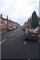
CV6 3HZ is a small residential postcode in Coventry, covering a compact cluster of 2,285 square metres. With a population of 1,815 and a density of 794,189 people per square kilometre, it is a densely populated yet tightly knit area. Nestled 1.5 miles north of Coventry city centre, it lies within the Coventry North West constituency. Historically, Radford was central to the British motor car industry, home to Daimler and Jaguar factories that operated until the mid-1990s. Today, the area retains a suburban character, with housing ranging from semi-detached homes to flats. The war memorial, unveiled in 1919, stands as a reminder of local history, while the Coventry Canal and Radford Brook add a quiet, natural element to daily life. Residents benefit from proximity to major transport routes, including rail stations and airports, and a mix of retail and leisure options nearby. The area’s compact size means it is ideal for those seeking a balance between suburban tranquillity and city accessibility.
- Area Type
- Postcode
- Area Size
- 2285 m²
- Population
- 1815
- Population Density
- 7992 people/km²
The property market in CV6 3HZ is characterised by a 47% home ownership rate, with houses being the predominant accommodation type. This suggests a mix of owner-occupied properties and rental stock, though the exact proportion of rentals is not specified. The area’s housing stock includes semi-detached and terraced homes, alongside blocks of flats, reflecting both historical council housing and private development. Given the small area size and high population density, the market is likely competitive, with limited new builds. Buyers should consider the proximity to Coventry’s industrial heritage, which may influence property values. The presence of both owner-occupied and rental properties indicates a diverse buyer base, though the compact nature of the postcode means opportunities are limited to immediate surroundings.
House Prices in CV6 3HZ
No properties found in this postcode.
Energy Efficiency in CV6 3HZ
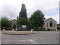
Living in CV6 3HZ offers a blend of convenience and local character. Nearby retail options include Aldi Radford, Asda Coventry, and Tesco Coventry, providing essential shopping within walking distance. The area’s rail network connects residents to Coventry’s cultural hubs, such as the Belgrade Theatre, while the Coventry Canal offers a scenic, historic route for leisure. The Radford Brook, though culverted, runs beneath the area, and Electric Wharf—a modern development on former power station land—adds contemporary appeal. The war memorial and remnants of the motor industry, like the former Daimler factory site, offer historical interest. This mix of retail, transport, and heritage makes daily life practical yet rooted in the area’s industrial past.
Amenities
Schools
| Rank | School | Type | Entry gender | Ages |
|---|
Explore more schools in this area
Go to Schools tabDemographics
The population of CV6 3HZ is predominantly adults aged 30–64, with a median age of 47. This suggests a community of established professionals and families. Home ownership sits at 47%, with the majority of properties being houses. The area is largely White in ethnicity, though specific diversity figures are not provided. The high population density—794,189 people per square kilometre—reflects a compact, urbanised environment. While this density may indicate a mix of long-term residents and those living in converted or shared housing, the data does not clarify deprivation levels. The prevalence of former council housing, now managed by Whitefriars Housing Group, suggests a history of public sector development. The age profile indicates a mature demographic, which may influence local amenities and services.
Household Size
Accommodation Type
Tenure
Ethnic Group
Religion
Household Composition
Age
Household Deprivation
NS-SEC
Explore more demographic insights in this area
Go to Demographics tabPlanning
Planning Constraints
- Flood RiskPremium
- Ramsar Wetland SitesPremium
- Area of Outstanding Natural BeautyPremium
- Protected Nature ReservePremium
- Protected WoodlandPremium