Area Overview for CV6 2BH
Photos of CV6 2BH
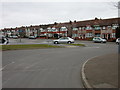
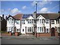
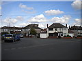
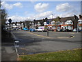
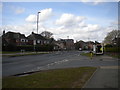
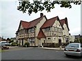
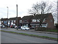
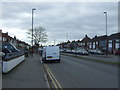
18 photos from this area
Area Information
Key information about the CV6 2BH including its size, population, and administrative classification.
- Area Type
- Postcode
- Area Size
- 5761 m²
- Population
- 1405
- Population Density
- 5553 people/km²
House Prices in CV6 2BH
20
Properties
£138,235
Average Sold Price
£48,000
Lowest Price
£270,000
Highest Price
Showing 20 properties
| Address | Type | Beds | Baths | Last Sale Price | Last Sale Date | |
|---|---|---|---|---|---|---|
| 98 Eversleigh Road, Coventry, CV6 2BH | Terraced | 3 | - | £270,000 | Sep 2022 | |
| 77 Eversleigh Road, Coventry, CV6 2BH | house | - | - | £220,000 | Mar 2021 | |
| 94 Eversleigh Road, Coventry, CV6 2BH | Terraced | 3 | 1 | £190,000 | Aug 2020 | |
| 110 Eversleigh Road, Coventry, CV6 2BH | Terraced | 3 | 1 | £180,000 | Sep 2018 | |
| 100 Eversleigh Road, Coventry, CV6 2BH | Terraced | 3 | 1 | £145,000 | Aug 2013 | |
| 90 Eversleigh Road, Coventry, CV6 2BH | Terraced | 2 | 1 | £124,150 | Apr 2013 | |
| 92 Eversleigh Road, Coventry, CV6 2BH | Terraced | - | - | £145,000 | Jul 2007 | |
| 106 Eversleigh Road, Coventry, CV6 2BH | Terraced | 3 | 2 | £189,950 | Jul 2005 | |
| 79 Eversleigh Road, Coventry, CV6 2BH | Terraced | - | - | £107,000 | Dec 2003 | |
| 81 Eversleigh Road, Coventry, CV6 2BH | Terraced | 3 | 1 | £74,950 | Apr 2000 |
Page 1 of 2
Energy Efficiency in CV6 2BH
Amenities
Schools
| Rank | School | Type | Entry gender | Ages |
|---|
Explore more schools in this area
Go to Schools tabDemographics
Household Size
Family (3-5 people)
most common
Accommodation Type
Houses
most common
Tenure
85
majority
Ethnic Group
White
most common
Religion
N/A
most common
Household Composition
N/A
most common
Age
47
median
Adults (30-64 years)
most common
Household Deprivation
N/A
with no deprivation
NS-SEC
34
in Lower managerial occupations
Explore more demographic insights in this area
Go to Demographics tabPlanning
Planning Constraints
- Flood RiskPremium
- Ramsar Wetland SitesPremium
- Area of Outstanding Natural BeautyPremium
- Protected Nature ReservePremium
- Protected WoodlandPremium