Area Overview for CV6 2BB
Photos of CV6 2BB
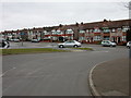
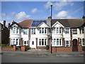
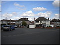
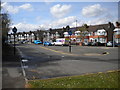
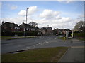
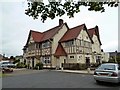
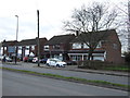
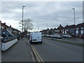
18 photos from this area
Area Information
Key information about the CV6 2BB including its size, population, and administrative classification.
- Area Type
- Postcode
- Area Size
- 1.3 hectares
- Population
- 1562
- Population Density
- 615 people/km²
House Prices in CV6 2BB
49
Properties
£155,505
Average Sold Price
£13,900
Lowest Price
£280,000
Highest Price
Showing 49 properties
| Address | Type | Beds | Baths | Last Sale Price | Last Sale Date | |
|---|---|---|---|---|---|---|
| 77 Birchfield Road, Coventry, CV6 2BB | Terraced | 3 | 1 | £280,000 | Dec 2025 | |
| 29 Birchfield Road, Coventry, CV6 2BB | Terraced | 3 | 2 | £220,000 | Oct 2025 | |
| 63 Birchfield Road, Coventry, CV6 2BB | Terraced | 3 | 1 | £238,000 | Sep 2025 | |
| 35 Birchfield Road, Coventry, CV6 2BB | Terraced | 3 | 1 | £168,800 | Sep 2024 | |
| 97 Birchfield Road, Coventry, CV6 2BB | Terraced | 3 | 1 | £212,000 | Aug 2024 | |
| 57 Birchfield Road, Coventry, CV6 2BB | Terraced | 3 | 1 | £190,000 | Jun 2024 | |
| 45 Birchfield Road, Coventry, CV6 2BB | Terraced | 3 | 1 | £227,000 | Apr 2024 | |
| 41 Birchfield Road, Coventry, CV6 2BB | house | 3 | 1 | £210,000 | Feb 2023 | |
| 55 Birchfield Road, Coventry, CV6 2BB | Terraced | 3 | 1 | £140,000 | Jul 2022 | |
| 103 Birchfield Road, Coventry, CV6 2BB | house | 3 | 1 | £262,000 | Jul 2022 |
Page 1 of 5
Energy Efficiency in CV6 2BB
Amenities
Schools
| Rank | School | Type | Entry gender | Ages |
|---|
Explore more schools in this area
Go to Schools tabDemographics
Household Size
Family (3-5 people)
most common
Accommodation Type
Houses
most common
Tenure
85
majority
Ethnic Group
White
most common
Religion
N/A
most common
Household Composition
N/A
most common
Age
47
median
Adults (30-64 years)
most common
Household Deprivation
N/A
with no deprivation
NS-SEC
37
in Lower managerial occupations
Explore more demographic insights in this area
Go to Demographics tabPlanning
Planning Constraints
- Flood RiskPremium
- Ramsar Wetland SitesPremium
- Area of Outstanding Natural BeautyPremium
- Protected Nature ReservePremium
- Protected WoodlandPremium