Area Overview for CV5 9BA
Photos of CV5 9BA
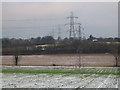
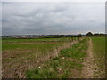

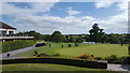

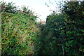

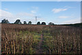
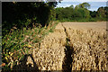

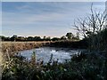
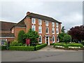
25 photos from this area
Area Information
Key information about the CV5 9BA including its size, population, and administrative classification.
- Area Type
- Postcode
- Area Size
- 17.7 hectares
- Population
- 1641
- Population Density
- 131 people/km²
House Prices in CV5 9BA
9
Properties
£246,044
Average Sold Price
£72,000
Lowest Price
£375,000
Highest Price
Showing 9 properties
| Address | Type | Beds | Baths | Last Sale Price | Last Sale Date | |
|---|---|---|---|---|---|---|
| Clarendon House, Birmingham Road, Allesley, Coventry, CV5 9BA | hospital_care_home | - | - | £243,174 | Jul 2016 | |
| The Gables, Birmingham Road, Coventry, CV5 9BA | Detached | - | - | £294,000 | Sep 2015 | |
| Glenallen, Birmingham Road, Allesley, Coventry, CV5 9BA | Semi-detached | - | - | £375,000 | Oct 2005 | |
| Hillcrest, Birmingham Road, Allesley, Coventry, CV5 9BA | Detached | - | - | £72,000 | Apr 1997 | |
| Flat Over, Stonebridge Manor, Birmingham Road, Allesley, Coventry, CV5 9BA | Flat | - | - | - | - | |
| My Safe Home, 1, Sycamore Court, Birmingham Road, Allesley, Coventry, CV5 9BA | office_workshop | - | - | - | - | |
| Sage Roofing, 3, Sycamore Court, Birmingham Road, Allesley, Coventry, CV5 9BA | office_workshop | - | - | - | - | |
| 5, Sycamore Court, Birmingham Road, Allesley, Coventry, CV5 9BA | office_workshop | - | - | - | - | |
| Ararna Ltd, 2, Sycamore Court, Birmingham Road, Allesley, Coventry, CV5 9BA | office_workshop | - | - | - | - |
Energy Efficiency in CV5 9BA
Amenities
Schools
| Rank | School | Type | Entry gender | Ages |
|---|
Explore more schools in this area
Go to Schools tabDemographics
Household Size
Two person
most common
Accommodation Type
Houses
most common
Tenure
91
majority
Ethnic Group
White
most common
Religion
N/A
most common
Household Composition
N/A
most common
Age
47
median
Adults (30-64 years)
most common
Household Deprivation
N/A
with no deprivation
NS-SEC
39
in Lower managerial occupations
Explore more demographic insights in this area
Go to Demographics tabPlanning
Planning Constraints
- Flood RiskPremium
- Ramsar Wetland SitesPremium
- Area of Outstanding Natural BeautyPremium
- Protected Nature ReservePremium
- Protected WoodlandPremium