Area Overview for CV5 9FR
Photos of CV5 9FR
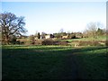
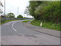
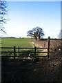

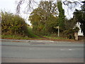
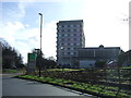


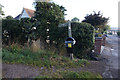
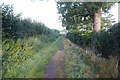


30 photos from this area
Area Information
Key information about the CV5 9FR including its size, population, and administrative classification.
- Area Type
- Postcode
- Area Size
- 8.2 hectares
- Population
- 1641
- Population Density
- 131 people/km²
House Prices in CV5 9FR
39
Properties
£229,862
Average Sold Price
£57,500
Lowest Price
£680,000
Highest Price
Showing 39 properties
| Address | Type | Beds | Baths | Last Sale Price | Last Sale Date | |
|---|---|---|---|---|---|---|
| 111 The Windmill Hill, Coventry, CV5 9FR | Semi-detached | 3 | 2 | £395,000 | Oct 2025 | |
| 83 The Windmill Hill, Coventry, CV5 9FR | Semi-detached | 3 | 2 | £432,500 | Mar 2025 | |
| 61 The Windmill Hill, Coventry, CV5 9FR | Semi-detached | 3 | 1 | £385,000 | Oct 2024 | |
| 87 The Windmill Hill, Coventry, CV5 9FR | Semi-detached | 3 | 3 | £417,000 | Oct 2023 | |
| 49 The Windmill Hill, Coventry, CV5 9FR | Maisonette | 2 | 1 | £175,000 | Sep 2023 | |
| 105 The Windmill Hill, Coventry, CV5 9FR | house | 2 | 1 | £378,000 | Sep 2022 | |
| 125 The Windmill Hill, Coventry, CV5 9FR | Semi-detached | 3 | 1 | £260,000 | Apr 2021 | |
| 79 The Windmill Hill, Coventry, CV5 9FR | house | 3 | 1 | £385,000 | Nov 2019 | |
| 47 The Windmill Hill, Coventry, CV5 9FR | Maisonette | 2 | 1 | £150,000 | Sep 2018 | |
| Inversnaid, The Windmill Hill, Coventry, CV5 9FR | Detached | 4 | 2 | £680,000 | Apr 2016 |
Page 1 of 4
Energy Efficiency in CV5 9FR
Amenities
Schools
| Rank | School | Type | Entry gender | Ages |
|---|
Explore more schools in this area
Go to Schools tabDemographics
Household Size
Two person
most common
Accommodation Type
Houses
most common
Tenure
91
majority
Ethnic Group
White
most common
Religion
N/A
most common
Household Composition
N/A
most common
Age
47
median
Adults (30-64 years)
most common
Household Deprivation
N/A
with no deprivation
NS-SEC
39
in Lower managerial occupations
Explore more demographic insights in this area
Go to Demographics tabPlanning
Planning Constraints
- Flood RiskPremium
- Ramsar Wetland SitesPremium
- Area of Outstanding Natural BeautyPremium
- Protected Nature ReservePremium
- Protected WoodlandPremium