Area Overview for CV5 8HZ
Photos of CV5 8HZ
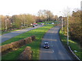
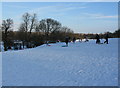

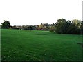
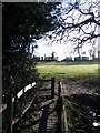
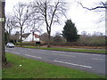
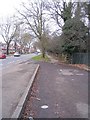
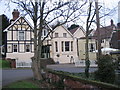
99 photos from this area
Area Information
Key information about the CV5 8HZ including its size, population, and administrative classification.
- Area Type
- Postcode
- Area Size
- 9225 m²
- Population
- 1514
- Population Density
- 7536 people/km²
House Prices in CV5 8HZ
26
Properties
£166,669
Average Sold Price
£74,500
Lowest Price
£265,000
Highest Price
Showing 26 properties
| Address | Type | Beds | Baths | Last Sale Price | Last Sale Date | |
|---|---|---|---|---|---|---|
| 45 Westbury Road, Coventry, CV5 8HZ | house | 3 | - | £265,000 | Jun 2024 | |
| 41 Westbury Road, Coventry, CV5 8HZ | house | - | - | £185,000 | Jan 2022 | |
| 87 Westbury Road, Coventry, CV5 8HZ | Maisonette | 2 | 1 | £145,000 | Nov 2021 | |
| 63 Westbury Road, Coventry, CV5 8HZ | Terraced | 3 | 1 | £230,500 | Nov 2020 | |
| 59 Westbury Road, Coventry, CV5 8HZ | Terraced | 3 | 1 | £225,100 | Oct 2020 | |
| 51 Westbury Road, Coventry, CV5 8HZ | Terraced | 3 | - | £234,000 | Jun 2019 | |
| 79 Westbury Road, Coventry, CV5 8HZ | house | - | - | £161,000 | Nov 2017 | |
| 69 Westbury Road, Coventry, CV5 8HZ | Terraced | 3 | 1 | £170,000 | Mar 2017 | |
| 65 Westbury Road, Coventry, CV5 8HZ | Terraced | 3 | 1 | £185,000 | Mar 2017 | |
| 61 Westbury Road, Coventry, CV5 8HZ | Terraced | 3 | 1 | £185,000 | Mar 2016 |
Page 1 of 3
Energy Efficiency in CV5 8HZ
Amenities
Schools
| Rank | School | Type | Entry gender | Ages |
|---|
Explore more schools in this area
Go to Schools tabDemographics
Household Size
Family (3-5 people)
most common
Accommodation Type
Houses
most common
Tenure
81
majority
Ethnic Group
White
most common
Religion
N/A
most common
Household Composition
N/A
most common
Age
47
median
Adults (30-64 years)
most common
Household Deprivation
N/A
with no deprivation
NS-SEC
37
in Lower managerial occupations
Explore more demographic insights in this area
Go to Demographics tabPlanning
Planning Constraints
- Flood RiskPremium
- Ramsar Wetland SitesPremium
- Area of Outstanding Natural BeautyPremium
- Protected Nature ReservePremium
- Protected WoodlandPremium