Area Overview for CV5 7LE
Photos of CV5 7LE
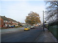


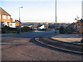
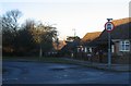

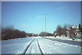
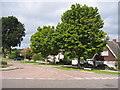
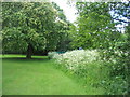
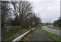
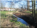
73 photos from this area
Area Information
Key information about the CV5 7LE including its size, population, and administrative classification.
- Area Type
- Postcode
- Area Size
- 9755 m²
- Population
- 1433
- Population Density
- 5321 people/km²
House Prices in CV5 7LE
29
Properties
£203,821
Average Sold Price
£88,000
Lowest Price
£345,000
Highest Price
Showing 29 properties
| Address | Type | Beds | Baths | Last Sale Price | Last Sale Date | |
|---|---|---|---|---|---|---|
| 36 Ettington Road, Coventry, CV5 7LE | Semi-detached | 3 | 2 | £305,000 | Apr 2024 | |
| 32 Ettington Road, Coventry, CV5 7LE | Semi-detached | 3 | 1 | £345,000 | Jul 2023 | |
| 52 Ettington Road, Coventry, CV5 7LE | house | - | - | £260,000 | Apr 2022 | |
| 50 Ettington Road, Coventry, CV5 7LE | house | - | - | £235,000 | Apr 2022 | |
| 12 Ettington Road, Coventry, CV5 7LE | house | - | - | £285,000 | Jan 2022 | |
| 20 Ettington Road, Coventry, CV5 7LE | Semi-detached | 3 | 1 | £302,500 | Oct 2020 | |
| 34 Ettington Road, Coventry, CV5 7LE | Semi-detached | 3 | 1 | £270,000 | Jul 2018 | |
| 42 Ettington Road, Coventry, CV5 7LE | Semi-detached | 3 | 2 | £270,000 | Apr 2017 | |
| 54 Ettington Road, Coventry, CV5 7LE | Terraced | 4 | 2 | £145,000 | May 2013 | |
| 26 Ettington Road, Coventry, CV5 7LE | Semi-detached | 3 | 1 | £171,500 | Nov 2012 |
Page 1 of 3
Energy Efficiency in CV5 7LE
Amenities
Schools
| Rank | School | Type | Entry gender | Ages |
|---|
Explore more schools in this area
Go to Schools tabDemographics
Household Size
Two person
most common
Accommodation Type
Houses
most common
Tenure
75
majority
Ethnic Group
White
most common
Religion
N/A
most common
Household Composition
N/A
most common
Age
47
median
Adults (30-64 years)
most common
Household Deprivation
N/A
with no deprivation
NS-SEC
33
in Lower managerial occupations
Explore more demographic insights in this area
Go to Demographics tabPlanning
Planning Constraints
- Flood RiskPremium
- Ramsar Wetland SitesPremium
- Area of Outstanding Natural BeautyPremium
- Protected Nature ReservePremium
- Protected WoodlandPremium