Area Overview for CV5 7JT
Photos of CV5 7JT
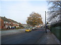


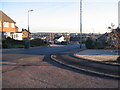
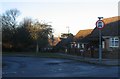

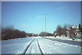
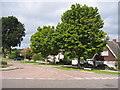
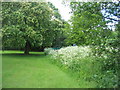
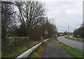
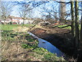
73 photos from this area
Area Information
Key information about the CV5 7JT including its size, population, and administrative classification.
- Area Type
- Postcode
- Area Size
- 6762 m²
- Population
- 1438
- Population Density
- 4858 people/km²
House Prices in CV5 7JT
20
Properties
£171,185
Average Sold Price
£57,666
Lowest Price
£305,000
Highest Price
Showing 20 properties
| Address | Type | Beds | Baths | Last Sale Price | Last Sale Date | |
|---|---|---|---|---|---|---|
| 79 Alderminster Road, Coventry, CV5 7JT | Semi-detached | 3 | 1 | £255,000 | Jul 2025 | |
| 75 Alderminster Road, Coventry, CV5 7JT | house | - | - | £305,000 | Sep 2022 | |
| 73 Alderminster Road, Coventry, CV5 7JT | Terraced | 3 | - | £220,000 | Sep 2020 | |
| 71 Alderminster Road, Coventry, CV5 7JT | house | - | - | £57,666 | Nov 2019 | |
| 81 Alderminster Road, Coventry, CV5 7JT | Semi-detached | 3 | 1 | £215,000 | Oct 2019 | |
| 69 Alderminster Road, Coventry, CV5 7JT | Flat | 1 | 1 | £190,000 | Jul 2019 | |
| 47B Alderminster Road, Coventry, CV5 7JT | Flat | 1 | 1 | £98,000 | Dec 2015 | |
| 49 Alderminster Road, Coventry, CV5 7JT | Flat | - | - | £100,000 | Dec 2010 | |
| 53 Alderminster Road, Coventry, CV5 7JT | Flat | - | - | £100,000 | Sep 2010 | |
| 77 Alderminster Road, Coventry, CV5 7JT | Semi-detached | 3 | 2 | - | - |
Page 1 of 2
Energy Efficiency in CV5 7JT
Amenities
Schools
| Rank | School | Type | Entry gender | Ages |
|---|
Explore more schools in this area
Go to Schools tabDemographics
Household Size
Two person
most common
Accommodation Type
Houses
most common
Tenure
84
majority
Ethnic Group
White
most common
Religion
N/A
most common
Household Composition
N/A
most common
Age
47
median
Adults (30-64 years)
most common
Household Deprivation
N/A
with no deprivation
NS-SEC
35
in Lower managerial occupations
Explore more demographic insights in this area
Go to Demographics tabPlanning
Planning Constraints
- Flood RiskPremium
- Ramsar Wetland SitesPremium
- Area of Outstanding Natural BeautyPremium
- Protected Nature ReservePremium
- Protected WoodlandPremium