Area Overview for CV5 6JZ
Photos of CV5 6JZ

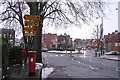
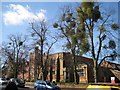
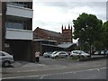
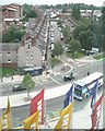
100 photos from this area
Area Information
Key information about the CV5 6JZ including its size, population, and administrative classification.
- Area Type
- Postcode
- Area Size
- 3957 m²
- Population
- 1291
- Population Density
- 11091 people/km²
House Prices in CV5 6JZ
23
Properties
£182,412
Average Sold Price
£60,000
Lowest Price
£300,000
Highest Price
Showing 23 properties
| Address | Type | Beds | Baths | Last Sale Price | Last Sale Date | |
|---|---|---|---|---|---|---|
| 80 Broomfield Road, Coventry, CV5 6JZ | Terraced | 6 | 6 | £215,000 | Dec 2024 | |
| 108 Broomfield Road, Coventry, CV5 6JZ | Terraced | 4 | 2 | £204,000 | Mar 2024 | |
| 96 Broomfield Road, Coventry, CV5 6JZ | Terraced | 6 | 2 | £300,000 | Sep 2023 | |
| 98 Broomfield Road, Coventry, CV5 6JZ | Terraced | 3 | 1 | £275,000 | Sep 2022 | |
| 76 Broomfield Road, Coventry, CV5 6JZ | Terraced | 2 | 1 | £232,000 | Jun 2022 | |
| 100 Broomfield Road, Coventry, CV5 6JZ | Terraced | 2 | 1 | £194,000 | Feb 2022 | |
| 110 Broomfield Road, Coventry, CV5 6JZ | house | - | - | £220,000 | Nov 2021 | |
| 94 Broomfield Road, Coventry, CV5 6JZ | Terraced | 3 | 1 | £225,000 | Apr 2021 | |
| 84 Broomfield Road, Coventry, CV5 6JZ | Terraced | 6 | 6 | £195,000 | Mar 2018 | |
| 92 Broomfield Road, Coventry, CV5 6JZ | Terraced | 4 | 1 | £211,000 | Dec 2017 |
Page 1 of 3
Energy Efficiency in CV5 6JZ
Amenities
Schools
| Rank | School | Type | Entry gender | Ages |
|---|
Explore more schools in this area
Go to Schools tabDemographics
Household Size
Two person
most common
Accommodation Type
Houses
most common
Tenure
44
majority
Ethnic Group
White
most common
Religion
N/A
most common
Household Composition
N/A
most common
Age
47
median
Adults (30-64 years)
most common
Household Deprivation
N/A
with no deprivation
NS-SEC
29
in Lower managerial occupations
Explore more demographic insights in this area
Go to Demographics tabPlanning
Planning Constraints
- Flood RiskPremium
- Ramsar Wetland SitesPremium
- Area of Outstanding Natural BeautyPremium
- Protected Nature ReservePremium
- Protected WoodlandPremium