Area Overview for CV5 6GH
Photos of CV5 6GH

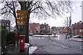
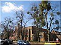
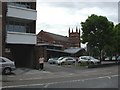
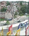
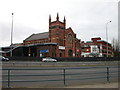
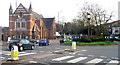
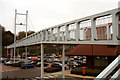
100 photos from this area
Area Information
Key information about the CV5 6GH including its size, population, and administrative classification.
- Area Type
- Postcode
- Area Size
- 1.0 hectares
- Population
- 1291
- Population Density
- 11091 people/km²
House Prices in CV5 6GH
55
Properties
£149,362
Average Sold Price
£40,000
Lowest Price
£275,000
Highest Price
Showing 55 properties
| Address | Type | Beds | Baths | Last Sale Price | Last Sale Date | |
|---|---|---|---|---|---|---|
| 102 Kensington Road, Coventry, CV5 6GH | house | 3 | 2 | £186,250 | Feb 2025 | |
| 92 Kensington Road, Coventry, CV5 6GH | Terraced | 3 | 1 | £228,000 | Apr 2024 | |
| 48 Kensington Road, Coventry, CV5 6GH | Terraced | 1 | 1 | £275,000 | Jan 2023 | |
| 90 Kensington Road, Coventry, CV5 6GH | house | - | - | £198,000 | Jul 2022 | |
| 66 Kensington Road, Coventry, CV5 6GH | house | 3 | 2 | £215,000 | Feb 2022 | |
| 28 Kensington Road, Coventry, CV5 6GH | Terraced | 3 | 2 | £232,500 | Sep 2021 | |
| 26 Kensington Road, Coventry, CV5 6GH | Terraced | 4 | 1 | £255,000 | Jun 2021 | |
| 64 Kensington Road, Coventry, CV5 6GH | Terraced | 3 | 1 | £205,000 | Jul 2020 | |
| 44 Kensington Road, Coventry, CV5 6GH | Terraced | 4 | - | £150,000 | Apr 2020 | |
| 58 Kensington Road, Coventry, CV5 6GH | house | 4 | - | £193,000 | Feb 2020 |
Page 1 of 6
Energy Efficiency in CV5 6GH
Amenities
Schools
| Rank | School | Type | Entry gender | Ages |
|---|
Explore more schools in this area
Go to Schools tabDemographics
Household Size
Two person
most common
Accommodation Type
Houses
most common
Tenure
44
majority
Ethnic Group
White
most common
Religion
N/A
most common
Household Composition
N/A
most common
Age
47
median
Adults (30-64 years)
most common
Household Deprivation
N/A
with no deprivation
NS-SEC
29
in Lower managerial occupations
Explore more demographic insights in this area
Go to Demographics tabPlanning
Planning Constraints
- Flood RiskPremium
- Ramsar Wetland SitesPremium
- Area of Outstanding Natural BeautyPremium
- Protected Nature ReservePremium
- Protected WoodlandPremium