Area Overview for CV5 6JF
Photos of CV5 6JF

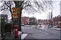
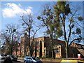
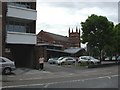
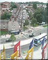
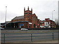
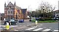
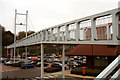
100 photos from this area
Area Information
Key information about the CV5 6JF including its size, population, and administrative classification.
- Area Type
- Postcode
- Area Size
- 4200 m²
- Population
- 1501
- Population Density
- 6968 people/km²
House Prices in CV5 6JF
16
Properties
£120,622
Average Sold Price
£34,000
Lowest Price
£199,000
Highest Price
Showing 16 properties
| Address | Type | Beds | Baths | Last Sale Price | Last Sale Date | |
|---|---|---|---|---|---|---|
| 169 Melbourne Road, Coventry, CV5 6JF | Terraced | 2 | 1 | £181,000 | Sep 2025 | |
| 179 Melbourne Road, Coventry, CV5 6JF | Terraced | 2 | - | £162,000 | Oct 2024 | |
| 183 Melbourne Road, Coventry, CV5 6JF | Terraced | 2 | 1 | £199,000 | Aug 2024 | |
| 185 Melbourne Road, Coventry, CV5 6JF | Terraced | 2 | 1 | £188,010 | Sep 2022 | |
| 187 Melbourne Road, Coventry, CV5 6JF | Retail | 2 | 1 | £185,000 | Aug 2022 | |
| 171 Melbourne Road, Coventry, CV5 6JF | Terraced | 2 | 1 | £113,500 | Oct 2016 | |
| 177 Melbourne Road, Coventry, CV5 6JF | Terraced | 2 | 1 | £119,000 | Jan 2016 | |
| 173 Melbourne Road, Coventry, CV5 6JF | Terraced | - | - | £115,000 | Apr 2007 | |
| 189 Melbourne Road, Coventry, CV5 6JF | house | - | - | £60,000 | Feb 2002 | |
| 167 Melbourne Road, Coventry, CV5 6JF | house | 2 | - | £42,000 | Mar 2000 |
Page 1 of 2
Energy Efficiency in CV5 6JF
Amenities
Schools
| Rank | School | Type | Entry gender | Ages |
|---|
Explore more schools in this area
Go to Schools tabDemographics
Household Size
One person
most common
Accommodation Type
Houses
most common
Tenure
47
majority
Ethnic Group
White
most common
Religion
N/A
most common
Household Composition
N/A
most common
Age
47
median
Adults (30-64 years)
most common
Household Deprivation
N/A
with no deprivation
NS-SEC
29
in Lower managerial occupations
Explore more demographic insights in this area
Go to Demographics tabPlanning
Planning Constraints
- Flood RiskPremium
- Ramsar Wetland SitesPremium
- Area of Outstanding Natural BeautyPremium
- Protected Nature ReservePremium
- Protected WoodlandPremium