Area Overview for CV1 3HG
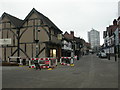
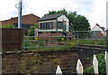
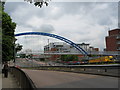
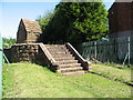
Photos of CV1 3HG


Area Information
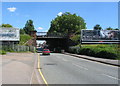
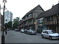
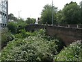
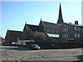
CV1 3HG is a small residential postcode cluster west of central Coventry, near the modern Coventry by-pass. With a population of 1,501, it lies within the Whoberley Ward, historically tied to areas like Hearsall Common and Whoberley Hall, now redeveloped as housing estates and playing fields. The area blends historical moated sites with modern living, offering a quiet residential environment close to Coventry’s urban core. Daily life here is shaped by its proximity to retail, transport, and green spaces. The median age of 47 suggests a mature community, with a focus on stability and family life. Residents benefit from nearby amenities, including five retail outlets, five railway stations, and a primary school with a good Ofsted rating. The area’s compact size means it is ideal for those seeking a balance between suburban comfort and city accessibility, though its limited scale means the housing market is tightly focused on a small cluster of properties.
- Area Type
- Postcode
- Area Size
- Not available
- Population
- 1501
- Population Density
- 6968 people/km²
The property market in CV1 3HG is characterised by a 47% home ownership rate, with houses forming the predominant accommodation type. This suggests a mix of owner-occupied and rental properties, though the exact proportion of the latter is unclear. The small area’s limited size means the housing stock is concentrated, with properties likely to be older or mid-century homes. Buyers should note that the market is not large, and competition for available properties may be keen. The focus on houses rather than flats implies a preference for family-friendly or larger living spaces. Proximity to retail, transport, and schools adds to the area’s appeal, though the compact nature of the postcode means buyers must consider nearby areas for broader options. The market’s stability aligns with the community’s mature demographic profile.
House Prices in CV1 3HG
Showing 1 properties
| Address | Type | Beds | Baths | Last Sale Price | Last Sale Date | |
|---|---|---|---|---|---|---|
| Archways Bathrooms, Archways House, 45 Spon End, Coventry, CV1 3HG | shop | - | - | - | - |
Energy Efficiency in CV1 3HG
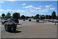
The lifestyle in CV1 3HG is shaped by its proximity to retail, transport, and green spaces. Within practical reach are five retail outlets, including Aldi Alvis Retail Park, Morrisons Coundon, and Iceland Coventry, offering everyday shopping convenience. Five railway stations provide access to Coventry’s urban centres and regional connections, while the area’s historical moated sites and playing fields hint at nearby green spaces for leisure. The presence of Coventry Airport, though not detailed further, may offer travel options for some residents. The small population and compact layout foster a tight-knit community feel, with amenities clustered closely. While the area lacks large-scale leisure facilities, the mix of retail, transport, and historical sites suggests a practical, low-maintenance lifestyle for those prioritising accessibility over expansive recreational options.
Amenities
Schools
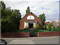
The primary school nearest to CV1 3HG is All Souls’ Catholic Primary School, which holds a good Ofsted rating. This school serves the local community, offering a faith-based education for younger children. The absence of secondary schools in the immediate vicinity means families may need to look further afield for secondary education, though the data does not specify nearby options. The presence of a primary school with a good rating is a key consideration for families prioritising quality education. Given the area’s median age and home ownership rate, it is likely that many residents are parents or grandparents, making the school a central feature of local life. The school’s performance suggests a focus on academic standards and community values, which may align with the area’s overall character.
| Rank | School | Type | Entry gender | Ages |
|---|
Explore more schools in this area
Go to Schools tabDemographics
The population of CV1 3HG is 1,501, with a median age of 47 and the most common age range being adults aged 30–64. This indicates a community skewed towards middle-aged and older residents, likely with established careers and families. Home ownership stands at 47%, suggesting a mix of owner-occupied and rental properties, though the exact proportion of renters is not specified. The area is predominantly composed of houses, not flats, aligning with a more traditional housing stock. The predominant ethnic group is White, though specific data on diversity or deprivation is not provided. The age profile and home ownership rate suggest a stable, low-turnover community, with a focus on long-term residency. The absence of younger demographics may mean fewer schools catering to children under 11, though All Souls’ Catholic Primary School serves the area.
Household Size
Accommodation Type
Tenure
Ethnic Group
Religion
Household Composition
Age
Household Deprivation
NS-SEC
Explore more demographic insights in this area
Go to Demographics tabPlanning
Planning Constraints
- Flood RiskPremium
- Ramsar Wetland SitesPremium
- Area of Outstanding Natural BeautyPremium
- Protected Nature ReservePremium
- Protected WoodlandPremium