Area Overview for CV5 6AL
Photos of CV5 6AL


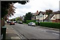
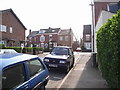
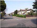
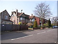
100 photos from this area
Area Information
Key information about the CV5 6AL including its size, population, and administrative classification.
- Area Type
- Postcode
- Area Size
- 1.0 hectares
- Population
- 1384
- Population Density
- 1317 people/km²
House Prices in CV5 6AL
22
Properties
£287,609
Average Sold Price
£116,750
Lowest Price
£555,000
Highest Price
Showing 22 properties
| Address | Type | Beds | Baths | Last Sale Price | Last Sale Date | |
|---|---|---|---|---|---|---|
| 40 Woodfield Road, Coventry, CV5 6AL | Retail | 3 | 2 | £555,000 | Sep 2022 | |
| 16 Woodfield Road, Coventry, CV5 6AL | house | - | - | £425,500 | Aug 2021 | |
| 28 Woodfield Road, Coventry, CV5 6AL | house | - | - | £425,000 | Nov 2019 | |
| 20 Woodfield Road, Coventry, CV5 6AL | house | - | - | £380,000 | May 2018 | |
| 8 Woodfield Road, Coventry, CV5 6AL | Detached | 3 | 1 | £360,000 | Apr 2018 | |
| 6 Woodfield Road, Coventry, CV5 6AL | Detached | 3 | 1 | £315,000 | Jan 2018 | |
| 42 Woodfield Road, Coventry, CV5 6AL | Detached | 3 | 1 | £348,500 | Oct 2017 | |
| 36 Woodfield Road, Coventry, CV5 6AL | house | - | - | £300,000 | Sep 2014 | |
| 34 Woodfield Road, Coventry, CV5 6AL | Detached | 3 | 1 | £270,000 | Sep 2013 | |
| 30 Woodfield Road, Coventry, CV5 6AL | house | 4 | 1 | £285,000 | Nov 2009 |
Page 1 of 3
Energy Efficiency in CV5 6AL
Amenities
Schools
| Rank | School | Type | Entry gender | Ages |
|---|
Explore more schools in this area
Go to Schools tabDemographics
Household Size
Two person
most common
Accommodation Type
Houses
most common
Tenure
94
majority
Ethnic Group
White
most common
Religion
N/A
most common
Household Composition
N/A
most common
Age
47
median
Adults (30-64 years)
most common
Household Deprivation
N/A
with no deprivation
NS-SEC
52
in Lower managerial occupations
Explore more demographic insights in this area
Go to Demographics tabPlanning
Planning Constraints
- Flood RiskPremium
- Ramsar Wetland SitesPremium
- Area of Outstanding Natural BeautyPremium
- Protected Nature ReservePremium
- Protected WoodlandPremium