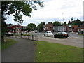
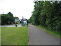
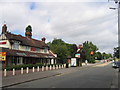
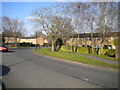
Area Overview for CV4 9TU
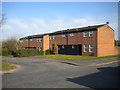
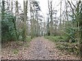
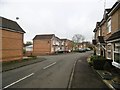
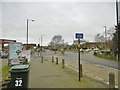
Photos of CV4 9TU


Area Information
CV4 9TU occupies a specific residential cluster within the Westwood Ward of Coventry City Council. This postcode covers 1.8 hectares and supports a population of 1,808 people. The area represents a semi-rural transition to suburban development, originally part of the historic Stoneleigh Estate. Residents live in a zone that was once an agricultural hamlet before becoming part of Coventry in 1927 under the Coventry Corporation (Boundary Extension) Act. Daily life here blends modern suburban convenience with historical character, featuring ribbon housing from the 1930s alongside later 20th-century developments. You can access the suburb of Westwood Heath, located near coordinates 52.393016, -1.59143, which anchors the wider local identity. This small area sits in the southwest of Coventry, offering a distinct neighbourhood atmosphere away from the city centre. Living in CV4 9TU means residing in a space that retains pockets of enclosed farmland while benefiting from established infrastructure. The location provides a practical balance for those seeking a home in a growing metropolitan area without the density of inner London or Birmingham.
- Area Type
- Postcode
- Area Size
- 1.8 hectares
- Population
- 1808
- Population Density
- 3537 people/km²
Homes in CV4 9TU are primarily houses, with 45% of the population being owner-occupiers. This statistic paints a clearer picture of the housing stock than rental metrics alone. The area is defined by residential clusters rather than a blocks of flats construction style. You will find properties that reflect the transition from semi-rural land to suburban settlement, including ribbon housing from the 1930s along roads like Westwood Heath Road. Because houses dominate the landscape, buyers looking for larger plots or standalone homes may find this postcode suitable. The 45% ownership rate signals that while many people buy to live here, nearly half rely on other housing arrangements. This mix can affect pressure on the local market, as owners typically have lower mobility than private renters. If you are considering purchase, the prevalence of house types means you should expect typical family layouts rather than studio or one-bedroom flats. Note that the small area size of 1.8 hectares limits the volume of active listings within the strict CV4 9TU boundary compared to larger districts.
House Prices in CV4 9TU
Showing 28 properties
| Address | Type | Beds | Baths | Last Sale Price | Last Sale Date | |
|---|---|---|---|---|---|---|
| 22 Ensign Close, Coventry, CV4 9TU | house | - | - | - | - | |
| 24 Ensign Close, Coventry, CV4 9TU | house | - | - | - | - | |
| 26 Ensign Close, Coventry, CV4 9TU | house | - | - | - | - | |
| 18 Ensign Close, Coventry, CV4 9TU | house | - | - | - | - | |
| 12 Ensign Close, Coventry, CV4 9TU | house | - | - | - | - | |
| 16 Ensign Close, Coventry, CV4 9TU | house | - | - | - | - | |
| 14 Ensign Close, Coventry, CV4 9TU | house | - | - | - | - | |
| 11 Ensign Close, Coventry, CV4 9TU | Terraced | - | - | - | - | |
| 34 Ensign Close, Coventry, CV4 9TU | house | - | - | - | - | |
| 42 Ensign Close, Coventry, CV4 9TU | house | - | - | - | - |
Energy Efficiency in CV4 9TU
Residents of CV4 9TU benefit from immediate access to a range of practical amenities. Five railway stations operate within practical reach, including Tile Hill Railway Station, Berkswell Railway Station, and Canley Railway Station. These stations connect you to wider UK travel networks. Local shopping conveniences include a Spar, Farmfoods Allesley, and Budgens Jardine. These retailers provide essentials without requiring a long journey into the city centre. Two airports, both listed as Coventry Airport, are located nearby, offering Occasional flying opportunities for residents. You do not need to travel far for groceries or commuting basics. The proximity of rail hubs saves time on daily obligations. While the area itself is compact, the surrounding network feels extensive. This setup supports a lifestyle where you handle most daily needs locally while retaining easy access to broader regional facilities. The mix of supermarkets and rail links creates a functional daily routine suitable for busy households.
Amenities
Schools
| Rank | School | Type | Entry gender | Ages |
|---|
Explore more schools in this area
Go to Schools tabDemographics
The community in CV4 9TU reflects an established neighbourhood with a median age of 47 years. Adults aged between 30 and 64 years form the most common age range in this residential cluster. This demographic profile suggests a population composed largely of families and individuals in their working lives rather than students or retirees. Home ownership stands at 45%, indicating that fewer than half of the residents legally own their property. This figure implies a significant rental presence alongside owner-occupied households. Houses are the predominant accommodation type, confirming that flats or apartments are not the primary housing solution here. The predominant ethnic group is White, which aligns with the broader demographic patterns of many suburban areas in the West Midlands. Understanding these figures helps you gauge the social fabric; you are likely to meet neighbours who have lived in the area for a considerable time. The age structure suggests a stable community focused on daily routine rather than transient student accommodation.
Household Size
Accommodation Type
Tenure
Ethnic Group
Religion
Household Composition
Age
Household Deprivation
NS-SEC
Explore more demographic insights in this area
Go to Demographics tabPlanning
Planning Constraints
- Flood RiskPremium
- Ramsar Wetland SitesPremium
- Area of Outstanding Natural BeautyPremium
- Protected Nature ReservePremium
- Protected WoodlandPremium