Area Overview for CV4 9TS
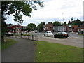
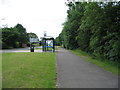
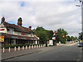
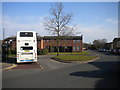
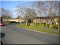
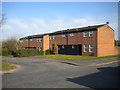
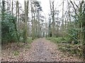
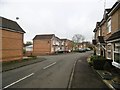
Photos of CV4 9TS


Area Information
Living in CV4 9TS means residing in a specific residential cluster within the Westwood Ward of Coventry City Council. This postcode covers an area of 7645 square metres and serves a population of 1808 people. The location represents a semi-rural suburb that has transitioned into suburban development, originally part of the Stoneleigh Estate before being incorporated into Coventry in 1927. Residents enjoy proximity to historical landmarks like St John the Baptist Church and the 18th-century Bockendon Grange Farm. The character of the area blends enclosed farmland with ribbon housing dating back to the 1930s and later 20th-century business parks. Although the population density reaches 236,482 people per square kilometre based on the total site area, the physical layout offers a distinct residential feel typical of the southwest suburbs. You will find yourself in a community that values its history, from the medieval granges to the Knights Templar associations recorded long after the first reference in 1250. Those considering homes in CV4 9TS can expect a standard suburban environment with pockets of transitional development.
- Area Type
- Postcode
- Area Size
- 7645 m²
- Population
- 1808
- Population Density
- 3537 people/km²
The property market for CV4 9TS is characterised by a substantial presence of houses, reflecting its origins as a developing suburb near the Stoneleigh Estate. Home ownership accounts for 45% of households, meaning nearly half of residents own their properties outright or with a mortgage. This level indicates a stable environment where people settle down rather than move frequently for short-term gains. Accommodation types are exclusively houses, which contrasts with parts of Coventry that feature high-rise council housing or large blocks of social flats. You are looking at a market where buyers typically expect detached, semi-detached, or terraced homes set within residential streets rather than apartment blocks. The 7645 square metre footprint supports a limited but concentrated number of dwellings, creating a tight-knit housing stock. Those seeking homes in CV4 9TS should expect competition between owner-occupied transfers and estate maintenance rather than speculative new builds. The area has evolved from agricultural land to a mix of 1930s ribbon housing and 20th-century developments, all contributing to a established housing stock.
House Prices in CV4 9TS
Showing 56 properties
| Address | Type | Beds | Baths | Last Sale Price | Last Sale Date | |
|---|---|---|---|---|---|---|
| 36 Winceby Place, Coventry, CV4 9TS | Flat | 1 | 1 | £105,000 | May 2025 | |
| 18 Winceby Place, Coventry, CV4 9TS | Flat | 1 | 1 | £85,000 | Nov 2023 | |
| 16 Winceby Place, Coventry, CV4 9TS | Flat | - | - | £96,000 | Dec 2022 | |
| 42 Winceby Place, Coventry, CV4 9TS | Flat | 1 | 1 | £81,000 | May 2021 | |
| 52 Winceby Place, Coventry, CV4 9TS | Flat | - | - | £80,000 | Feb 2021 | |
| 32 Winceby Place, Coventry, CV4 9TS | Flat | 1 | 1 | £94,250 | Sep 2019 | |
| 34 Winceby Place, Coventry, CV4 9TS | Maisonette | 1 | - | £64,050 | Apr 2015 | |
| 104 Winceby Place, Coventry, CV4 9TS | Flat | - | - | - | - | |
| 64 Winceby Place, Coventry, CV4 9TS | Flat | - | - | - | - | |
| 96 Winceby Place, Coventry, CV4 9TS | Flat | - | - | - | - |
Energy Efficiency in CV4 9TS
Daily life in CV4 9TS is enhanced by amenities within practical walking or driving distance. Residents have access to five retail locations, notably Spar, Farmfoods Allesley, and Budgens Jardine, meeting basic shopping needs without a long journey. For those requiring rail travel, five stations are nearby, including Tile Hill, Berkswell, and Canley Railway Stations. This variety means you can choose a connection that suits your schedule best. Travel time to Coventry Airport is minimal, with two airports listed in the immediate vicinity for business or leisure flights. While Coventry is the dominant urban centre nearby, the local retail provision means you do not always need to venture into the city for groceries. The layout includes closed terraces and ribbon housing along Westwood Heath Road and Cromwell Lane, offering a sense of locality. You will find the area supports a self-sufficient lifestyle where routine errands are manageable. The proximity to network rail facilities also adds value for professionals working from the city.
Amenities
Schools
| Rank | School | Type | Entry gender | Ages |
|---|
Explore more schools in this area
Go to Schools tabDemographics
The community in CV4 9TS is defined by a predominantly White population with a median age of 47 years. Most residents fall into the adult age range between 30 and 64 years, indicating a mature demographic often associated with established families or retirees. Household stability is evident, with home ownership standing at 45% across this specific postcode area. This figure suggests a balanced mix of owner-occupiers and landlords. The accommodation type is chiefly houses, reinforcing the suburban nature of the cluster rather than high-density flats. You will not find a young student population or transient workforce dominating the street scenes here. The consistent profile points toward a neighbourhood where long-term residents maintain their properties and engage with local institutions. Data confirms that the area lacks the rapid gentrification signs often found in younger urban pockets. Instead, the demographic structure supports a steady pace of life.
Household Size
Accommodation Type
Tenure
Ethnic Group
Religion
Household Composition
Age
Household Deprivation
NS-SEC
Explore more demographic insights in this area
Go to Demographics tabPlanning
Planning Constraints
- Flood RiskPremium
- Ramsar Wetland SitesPremium
- Area of Outstanding Natural BeautyPremium
- Protected Nature ReservePremium
- Protected WoodlandPremium