Area Overview for CV4 9TG
Photos of CV4 9TG
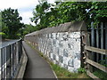
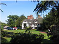

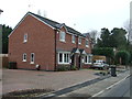
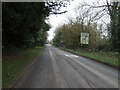
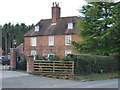

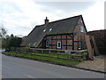
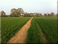
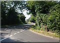
24 photos from this area
Area Information
Key information about the CV4 9TG including its size, population, and administrative classification.
- Area Type
- Postcode
- Area Size
- 5.9 hectares
- Population
- 1880
- Population Density
- 237 people/km²
House Prices in CV4 9TG
21
Properties
£266,469
Average Sold Price
£84,000
Lowest Price
£380,000
Highest Price
Showing 21 properties
| Address | Type | Beds | Baths | Last Sale Price | Last Sale Date | |
|---|---|---|---|---|---|---|
| 3 Lant Close, Berkswell, Solihull, CV4 9TG | Detached | 4 | 1 | £360,000 | Jul 2024 | |
| 6 Lant Close, Berkswell, Solihull, CV4 9TG | Detached | 4 | 1 | £380,000 | Mar 2021 | |
| 9 Lant Close, Berkswell, Solihull, CV4 9TG | house | - | - | £365,000 | Feb 2021 | |
| 4 Lant Close, Berkswell, Solihull, CV4 9TG | Detached | 4 | 2 | £369,000 | Dec 2020 | |
| 14 Lant Close, Berkswell, Solihull, CV4 9TG | Detached | 4 | 1 | £290,000 | Apr 2019 | |
| 28 Lant Close, Berkswell, Solihull, CV4 9TG | Detached | 5 | 1 | £355,000 | Jan 2019 | |
| 8 Lant Close, Berkswell, Solihull, CV4 9TG | Detached | 4 | 4 | £370,000 | Aug 2018 | |
| 24 Lant Close, Berkswell, Solihull, CV4 9TG | house | - | - | £297,000 | Jan 2017 | |
| 18 Lant Close, Berkswell, Solihull, CV4 9TG | Detached | 4 | - | £220,000 | Nov 2013 | |
| 26 Lant Close, Berkswell, Solihull, CV4 9TG | house | 4 | - | £240,000 | Oct 2010 |
Page 1 of 3
Energy Efficiency in CV4 9TG
Amenities
Schools
| Rank | School | Type | Entry gender | Ages |
|---|
Explore more schools in this area
Go to Schools tabDemographics
Household Size
Family (3-5 people)
most common
Accommodation Type
Houses
most common
Tenure
87
majority
Ethnic Group
White
most common
Religion
N/A
most common
Household Composition
N/A
most common
Age
47
median
Adults (30-64 years)
most common
Household Deprivation
N/A
with no deprivation
NS-SEC
50
in Lower managerial occupations
Explore more demographic insights in this area
Go to Demographics tabPlanning
Planning Constraints
- Flood RiskPremium
- Ramsar Wetland SitesPremium
- Area of Outstanding Natural BeautyPremium
- Protected Nature ReservePremium
- Protected WoodlandPremium