Area Overview for CV4 9SX
Photos of CV4 9SX
Area Information
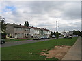
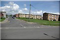
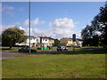
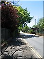
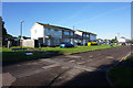
Postcode CV4 9SX sits within Westwood Ward in Coventry City Council, covering a small residential cluster of just 3,094 square metres. This specific location serves a population of 1,999 people within the broader Stoneleigh Estate hamlet area that was incorporated into Coventry in 1927. The land history reveals a transition from medieval common land and Cistercian monk granges to enclosed farmland and ribbon housing developed along Westwood Heath Road and Cromwell Lane during the 1930s. Today, the area retains semi-rural elements alongside the more established suburban character found in nearby Westwood Heath. Residents live in a setting defined by St John the Baptist Church, which opened in 1844, and landmarks like Bockendon Grange Farm. While the neighbourhood boundaries are precise, the local feel reflects a zone that evolved from agricultural roots into a residential suburb of the wider city. Living in CV4 9SX means accessing the practical benefits of proximity to Coventry without being surrounded by high-density urban sprawl.
- Area Type
- Postcode
- Area Size
- 3094 m²
- Population
- 1999
- Population Density
- 2348 people/km²
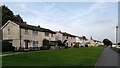
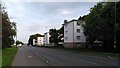
Homes in CV4 9SX are almost exclusively houses, catering to buyers seeking detached or semi-detached properties rather than apartments or flats. This accommodation type aligns with the area's history of 1930s ribbon housing on Westwood Heath Road and later 20th-century development including business parks. Only 34% of the 1,999 residents in this postcode hold a home ownership stake, meaning two-thirds live in rented accommodation or other tenure types. This statistic signals that the market may include a healthy number of rental properties alongside owner-occupied stock. Current property listings would focus largely on family-sized houses within the Westwood Heath character area rather than high-rise conversions. For first-time buyers or investors, the lower ownership rate presents an opportunity to enter the local market, though specific sale prices for CV4 9SX are not included in the current data. The housing stock benefits from no Ramsar wetland constraints or AONB limitations, simplifying planning considerations.
House Prices in CV4 9SX
Showing 1 properties
| Address | Type | Beds | Baths | Last Sale Price | Last Sale Date | |
|---|---|---|---|---|---|---|
| L Darby And Son, Torrington Avenue, Coventry, CV4 9SX | office_workshop | - | - | - | - |
Energy Efficiency in CV4 9SX
Residents of CV4 9SX enjoy practical access to local amenities within a short drive. Five rail stations, five retail outlets, and two airports fall within the practical reach of daily life. Local shopping is available at Farmfoods Allesley and Budgens Jardine, supplemented by the Heart of England Co-operative Co. These venues provide essential groceries and daily necessities close to home. Tile Hill Railway Station, Canley Railway Station, and Berkswell Railway Station offer quick connections to the rest of the Coventry network. The nearby airports, listed twice as Coventry Airport, serve business travellers and leisure flyers alike. While the area has no protected nature reserves or woodlands, the nearby Network Rail Training College provides a significant local landmark. The lifestyle here balances suburban convenience with proximity to major transport hubs, allowing you to navigate both the immediate neighbourhood and the wider region with ease.
Amenities
Schools
Families in CV4 9SX have access to Finham Park 2, a primary academy located near the postcode. This institution holds a good Ofsted rating, providing a solid educational foundation for local children. The school represents the main educational claim for residents within this small residential cluster. No secondary schools are listed as immediately adjacent to CV4 9SX in the provided data, so families will likely look further into Coventry for secondary education options. The single academy in the immediate vicinity suggests a stable educational environment without the complexity of mixed academic ratings. Living in CV4 9SX means your children can attend a school with a verified good rating in the academy sector. The presence of just one applicable school in the nearby data highlights the need for careful home selection if you require proximity to multiple educational choices.
| Rank | School | Type | Entry gender | Ages |
|---|
Explore more schools in this area
Go to Schools tabDemographics
The community residing in CV4 9SX reflects a young demographic profile with a median age of 22 years. Most of the population falls into the 30-64 years age range, suggesting a balance between young professionals and established families. The area predominantly comprises White ethnic groups, matching wider regional trends in this part of the West Midlands. Housing arrangements show a mixed household structure with only 34% of residents owning their homes, indicating a significant presence of private renters or those in the property ladder. The accommodation type is primarily houses, fitting the semi-rural and suburban character of the ward. This specific postcode area does not show data on private sector deprivation indices, but the housing mix suggests diversity in tenure. With a population density of 646,193 people per square kilometre reported for this small cluster, residents live in close proximity to neighbours yet maintain access to the wider facilities of the Coventry suburbs.
Household Size
Accommodation Type
Tenure
Ethnic Group
Religion
Household Composition
Age
Household Deprivation
NS-SEC
Explore more demographic insights in this area
Go to Demographics tabPlanning
Planning Constraints
- Flood RiskPremium
- Ramsar Wetland SitesPremium
- Area of Outstanding Natural BeautyPremium
- Protected Nature ReservePremium
- Protected WoodlandPremium