Area Overview for CV4 9JZ
Photos of CV4 9JZ
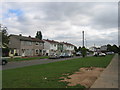
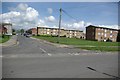
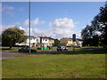
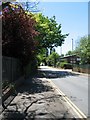
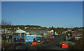
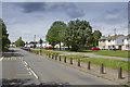
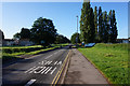
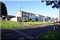
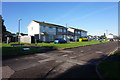
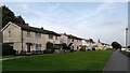
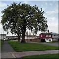
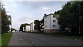
22 photos from this area
Area Information
Key information about the CV4 9JZ including its size, population, and administrative classification.
- Area Type
- Postcode
- Area Size
- 1.3 hectares
- Population
- 1733
- Population Density
- 5264 people/km²
House Prices in CV4 9JZ
40
Properties
£124,443
Average Sold Price
£58,000
Lowest Price
£220,000
Highest Price
Showing 40 properties
| Address | Type | Beds | Baths | Last Sale Price | Last Sale Date | |
|---|---|---|---|---|---|---|
| 49 Ridgley Road, Coventry, CV4 9JZ | Detached | 3 | 1 | £220,000 | Aug 2025 | |
| 57 Ridgley Road, Coventry, CV4 9JZ | house | - | - | £161,000 | Jun 2023 | |
| 67 Ridgley Road, Coventry, CV4 9JZ | Maisonette | 2 | 1 | £110,000 | Jun 2022 | |
| 61 Ridgley Road, Coventry, CV4 9JZ | house | - | - | £195,000 | Apr 2022 | |
| 47 Ridgley Road, Coventry, CV4 9JZ | Semi-detached | 3 | 1 | £190,000 | Jul 2020 | |
| 41 Ridgley Road, Coventry, CV4 9JZ | house | - | - | £84,700 | Jul 2020 | |
| 55 Ridgley Road, Coventry, CV4 9JZ | Semi-detached | 3 | 1 | £165,000 | Jan 2019 | |
| 33 Ridgley Road, Coventry, CV4 9JZ | Semi-detached | 3 | 1 | £135,000 | Nov 2014 | |
| 31 Ridgley Road, Coventry, CV4 9JZ | house | - | - | £112,000 | Nov 2014 | |
| 45 Ridgley Road, Coventry, CV4 9JZ | Semi-detached | 3 | - | £118,000 | May 2014 |
Page 1 of 4
Energy Efficiency in CV4 9JZ
Amenities
Schools
| Rank | School | Type | Entry gender | Ages |
|---|
Explore more schools in this area
Go to Schools tabDemographics
Household Size
One person
most common
Accommodation Type
Houses
most common
Tenure
50
majority
Ethnic Group
White
most common
Religion
N/A
most common
Household Composition
N/A
most common
Age
47
median
Adults (30-64 years)
most common
Household Deprivation
N/A
with no deprivation
NS-SEC
26
in Lower managerial occupations
Explore more demographic insights in this area
Go to Demographics tabPlanning
Planning Constraints
- Flood RiskPremium
- Ramsar Wetland SitesPremium
- Area of Outstanding Natural BeautyPremium
- Protected Nature ReservePremium
- Protected WoodlandPremium