Area Overview for CV4 9LJ
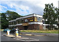
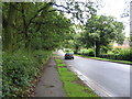
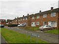
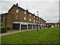
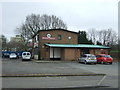
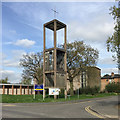
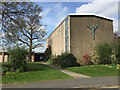
Photos of CV4 9LJ

Area Information
CV4 9LJ is a specific postcode area covering a small residential cluster within Woodlands Ward in Coventry. This compact zone spans 9,096 square metres and is home to 1,498 residents. The area sits within a city that grew to prominence during the Middle Ages as an important centre due to its booming cloth and wool industries. Living in CV4 9LJ means residing in a dense, unitary ward containing approximately 6,500 homes across a limited footprint. The population density here is exceptionally high at 164,691 people per square kilometre, reflecting the urban nature of this Coventry location. You will find yourself in a community where space is at a premium, yet the historical significance of the wider Woodlands Ward is palpable. This ward contains Woodlands School, which opened in September 1954 as one of the first purpose-built comprehensive schools in the country. The school complex includes heritage buildings like the Malins and Perrens block and the Arts and Crafts block. These structures remain integral features of the local landscape. The area's character is defined by this mix of dense modern living and historical architectural merit. As you look for homes in CV4 9LJ, you are entering a neighbourhood with deep roots, situated just east of the city centre. The immediate surroundings are tightly knit, offering a distinct slice of West Midlands life within a larger, historically rich environment.
- Area Type
- Postcode
- Area Size
- 9096 m²
- Population
- 1498
- Population Density
- 2517 people/km²
Homes in CV4 9LJ are primarily houses, and over half of the residents own their property outright or via mortgage. This high level of home ownership at 52 per cent points toward a stable market rather than a transient rental economy. The total area of this postcode is only 9,096 square metres, which means the volume of housing stock is naturally limited. You are unlikely to find a wide variety of price points or architectural styles within this single, small cluster. The predominant accommodation type being houses suggests a market geared toward buyers rather than long-term tenants. If you are looking at this postcode, you will find that inventory levels will be low compared to larger districts in Coventry. The fact that the majority of residents are owners indicates that these are places people intend to keep for the foreseeable future. This stability often supports steady property values, although the scarcity of units creates a competitive environment. When searching for properties, you may need to consider the immediate surroundings of Woodlands Ward to broaden your options. The wards around you will share similar characteristics of home ownership and housing types. Buying here requires patience and careful research, as the small footprint of the area restricts the sheer number of transactions that can occur annually.
House Prices in CV4 9LJ
Showing 39 properties
| Address | Type | Beds | Baths | Last Sale Price | Last Sale Date | |
|---|---|---|---|---|---|---|
| 61 Roosevelt Drive, Coventry, CV4 9LJ | Terraced | 3 | 1 | £165,000 | Jul 2025 | |
| 71 Roosevelt Drive, Coventry, CV4 9LJ | house | - | - | £180,000 | Aug 2023 | |
| 73 Roosevelt Drive, Coventry, CV4 9LJ | house | - | - | £150,000 | Apr 2022 | |
| 29 Roosevelt Drive, Coventry, CV4 9LJ | Terraced | 3 | 2 | £155,000 | Jun 2021 | |
| 33 Roosevelt Drive, Coventry, CV4 9LJ | house | 3 | 1 | £195,000 | Jun 2021 | |
| 7 Roosevelt Drive, Coventry, CV4 9LJ | Terraced | 3 | 1 | £136,000 | Aug 2020 | |
| 55 Roosevelt Drive, Coventry, CV4 9LJ | Terraced | 3 | 1 | £136,000 | Sep 2019 | |
| 5 Roosevelt Drive, Coventry, CV4 9LJ | Semi-detached | 3 | 2 | £128,000 | Feb 2018 | |
| 53 Roosevelt Drive, Coventry, CV4 9LJ | house | - | - | £85,000 | Jul 2014 | |
| 35 Roosevelt Drive, Coventry, CV4 9LJ | Terraced | 3 | 1 | £77,000 | Nov 2012 |
Energy Efficiency in CV4 9LJ
The lifestyle in CV4 9LJ is defined by proximity to essential amenities within walking or short driving distance. Five retail outlets are easily accessible, including Farmfoods Allesley, Budgens Jardine, and Spar. These venues provide daily necessities and convenience for residents. For commuters and travellers, rail connectivity is a key lifestyle feature. Five railway stations are nearby, including Tile Hill Railway Station, Canley Railway Station, and Berkswell Railway Station. These links offer regular train services to major cities across the UK. Travel plans can also utilise two nearby airports, both identified as Coventry Airport in the current records. This dual access to rail and air networks provides flexibility for both business and leisure trips. Living in CV4 9LJ means you do not need to travel far for groceries or transport links. The convenience of these nearby amenities supports a busy, active household routine. You will find the necessary shops and stations within practical reach, reducing the need for long journeys. The combination of retail options and transport hubs creates a self-sufficient daily environment. Residents can manage their weekly shopping, commuting, and holiday travel without venturing too far from their doorstep.
Amenities
Schools
There are three primary educational institutions located near CV4 9LJ that serve the local families. Our Lady of the Assumption Catholic Primary School holds a good Ofsted rating and is a key option for younger children. Tile Hill Wood School and Language College operates as a primary school without a published rating in the current data. Further afield for older students, West Coventry Academy also carries a good Ofsted rating. This mix of institutions offers a range of educational environments. Two of the three schools have achieved a good rating, which is a strong endorsement of their performance standards. The presence of a Catholic primary school alongside other primary and academy options provides diversity in curriculum and ethos. For families planning to live in CV4 9LJ, these schools represent the main educational resources within practical reach. While specific catchment areas are not detailed in the provided text, the proximity of these three institutions suggests they are the natural first choice for parents in the CV4 9LJ postcode. The good ratings at Our Lady of the Assumption Catholic Primary School and West Coventry Academy indicate high quality standards that attract families to the Woodlands Ward area.
| Rank | School | Type | Entry gender | Ages |
|---|
Explore more schools in this area
Go to Schools tabDemographics
The community in CV4 9LJ is predominantly composed of adults aged 30 to 64 years. The median age for this area is 47, indicating a mature demographic profile. Fifty-two per cent of residents own their homes, suggesting a stable population less likely to move frequently. Over half of the accommodation consists of houses, which forms the backbone of the local housing stock. The dominant ethnic group in CV4 9LJ is White, which aligns with the broader historical context of the Woodlands Ward. You will not find significant demographic data regarding deprivation levels provided in the current records, so any assessment of local economic hardship relies on external indicators. The absence of specific statistics on income or joblessness in the available data means you cannot make precise claims about economic disparity within this 1,498-strong population. Instead, the clear picture is one of a middle-aged, home-owning community with a strong preference for detached or semi-detached housing. This demographic stability often correlates with established families or retired professionals choosing to stay put. The high home ownership rate can make purchasing a property in CV4 9LJ more affordable compared to high-rent areas, though the limited total population may restrict the choice of specific properties available to you.
Household Size
Accommodation Type
Tenure
Ethnic Group
Religion
Household Composition
Age
Household Deprivation
NS-SEC
Explore more demographic insights in this area
Go to Demographics tabPlanning
Planning Constraints
- Flood RiskPremium
- Ramsar Wetland SitesPremium
- Area of Outstanding Natural BeautyPremium
- Protected Nature ReservePremium
- Protected WoodlandPremium