Area Overview for CV4 9LG
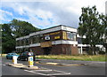
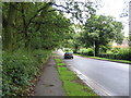
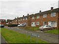
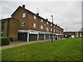
Photos of CV4 9LG

Area Information
Living in CV4 9LG offers a specific residential experience within the Woodlands Ward of Coventry. This postcode covers a small residential cluster occupying just 4,579 square metres. You will find a population of 1,498 residents concentrated in this compact space, resulting in a very high local density. The area sits at coordinates 52.406833, -1.578558, placing you firmly within a part of the city with deep historical roots. Coventry itself has a documented history stretching back over a thousand years, originating from a Saxon nunnery founded around AD 700 by St Osburga. The city achieved formal recognition through King Edward III in 1345. While the wider area boasts grand histories, CV4 9LG functions as a modern residential unit. The ward includes Woodlands School, which opened in September 1954 as one of the first purpose-built comprehensive schools in the country. This educational landmark, located on Broad Lane, features listed buildings designed using the innovative Hills system. Your daily life here is defined by proximity to these city-scale heritage sites while residing in a tight-knit, defined cluster.
- Area Type
- Postcode
- Area Size
- 4579 m²
- Population
- 1498
- Population Density
- 2517 people/km²
The property market in CV4 9LG is characterised by a distinct lack of flats. Your data indicates that houses are the predominant accommodation type in this postcode area. This creates a residential landscape focused on detached or semi-detached dwellings typical of suburban or semi-urban planning. With a home ownership rate of 52%, the area leans heavily towards owner-occupied stock rather than a high-rise rental market. You are purchasing into a community where nearly half of the population secures their own equity. This specific postcode covers a small residential cluster, which means the available housing stock is limited to the immediate vicinity of the 1,498 residents. The absence of flat-based accommodation highlights a traditional housing profile suitable for families or individuals seeking standalone living spaces. Buyers looking for this area should expect a consistent architectural style typical of older established estates or purpose-built school complexes nearby.
House Prices in CV4 9LG
Showing 14 properties
| Address | Type | Beds | Baths | Last Sale Price | Last Sale Date | |
|---|---|---|---|---|---|---|
| 17 Frisby Road, Coventry, CV4 9LG | house | - | - | £121,000 | Jun 2020 | |
| 29 Frisby Road, Coventry, CV4 9LG | house | - | - | £122,500 | Apr 2019 | |
| 9 Frisby Road, Coventry, CV4 9LG | Flat | - | - | £74,500 | Dec 2015 | |
| 31 Frisby Road, Coventry, CV4 9LG | house | 3 | - | £94,000 | Aug 2011 | |
| 39 Frisby Road, Coventry, CV4 9LG | house | - | - | £91,000 | Jun 2007 | |
| 15 Frisby Road, Coventry, CV4 9LG | house | 3 | - | - | - | |
| 5 Frisby Road, Coventry, CV4 9LG | undefined | - | - | - | - | |
| 37 Frisby Road, Coventry, CV4 9LG | house | - | - | - | - | |
| 13 Frisby Road, Coventry, CV4 9LG | Terraced | - | - | - | - | |
| 33 Frisby Road, Coventry, CV4 9LG | Terraced | - | - | - | - |
Energy Efficiency in CV4 9LG
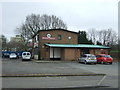
Residents of CV4 9LG can shop at specific named venues within easy reach of their homes. Farmfoods Allesley, Budgens Jardine, and Spar are the notable retail options available to you. These supermarkets provide daily essentials for all your household needs. You do not need to leave the immediate vicinity to buy groceries or household items. Retail density includes five key shops, ensuring convenience is never compromised in this small residential cluster. Beyond shopping, transport hubs bring the wider city to your doorstep. Five railway stations serve the local population, including Tile Hill, Canley, and Berkswell stations. These links connect you to the wider transport network for occasion travel or daily commuting. Additionally, Coventry Airport is listed twice as a notable amenity within practical reach. The presence of two airport sites confirms strong regional connectivity. Your lifestyle is defined by the ability to access major retail chains and transport links without significant travel time.
Amenities
Schools
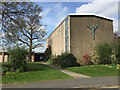
Families living in CV4 9LG have access to three specific educational institutions within practical reach. Our Lady of the Assumption Catholic Primary School operates as a primary school and holds an Ofsted rating of good. This facility offers a verified standard of education for younger children in the locality. Tile Hill Wood School and Language College also serves the primary education sector. A third option is West Coventry Academy, which functions as an academy and carries an Ofsted rating of good. The presence of two schools with good ratings suggests a consistent standard of provision across the different types of institutions available. Your options include both faith-based provision and academy trusts. This mix allows you to choose between Catholic education and secular academy schooling without needing to travel far. These schools form the backbone of the ward's amenities, supported by the historic presence of Woodlands School nearby, which opened in 1954.
| Rank | School | Type | Entry gender | Ages |
|---|
Explore more schools in this area
Go to Schools tabDemographics
The community in CV4 9LG is dominated by adults aged between 30 and 64 years. This age group represents the most common demographic within the postcode area. With a median age of 47, the population skew suggests a neighbourhood where many residents have established careers and families. The area is predominantly inhabited by the White ethnic group, which remains the predominant demographic category for this location. Regarding housing tenure, 52% of residents own their homes outright. This figure indicates that owner-occupiers form the majority of the community. Over half of the people living here have secured their own property, rather than renting or living with family. The accommodation type data confirms that houses are the primary style of dwelling in this cluster. You are looking at an area where permanent residents and families have stayed put for a considerable time. The high home ownership percentage points to stability within the household structure.
Household Size
Accommodation Type
Tenure
Ethnic Group
Religion
Household Composition
Age
Household Deprivation
NS-SEC
Explore more demographic insights in this area
Go to Demographics tabPlanning
Planning Constraints
- Flood RiskPremium
- Ramsar Wetland SitesPremium
- Area of Outstanding Natural BeautyPremium
- Protected Nature ReservePremium
- Protected WoodlandPremium