Area Overview for CV4 9GU
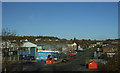
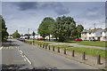
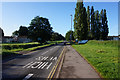
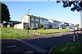
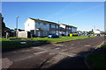
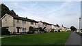
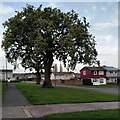
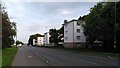
Photos of CV4 9GU
Area Information
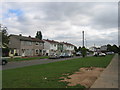
Living in CV4 9GU means residing within Westwood Ward, a small residential cluster encompassing 1.3 hectares in the southwest of Coventry. This postcode covers a population of 1999 people, creating an intimate community feel despite its location near the transition from semi-rural farmland to suburban development. The area originally formed part of the Stoneleigh Estate hamlet before incorporating into Coventry in 1927. You are positioned in a locality that blends historic agricultural roots with modern housing. The character of the neighbourhood reflects its history, featuring ribbon housing from the 1930s alongside later 20th-century business parks and enclosed farmland. Locations like Westwood Heath Road and Cromwell Lane define the immediate surroundings, offering a setting that feels distinct from the wider city centre. The demographic profile shows a median age of 22 years, suggesting a community with a significant number of young adults alongside families. While specific details on tenures vary, the area possesses a defined residential identity within the larger Coventry planning structure. Residents here benefit from proximity to historic landmarks such as St John the Baptist Church and Bockendon Grange Farm, which add historical depth to everyday life. The geographical constraints of this 1.3-hectare zone mean that daily routines are compact, with essential services and transport links clustered within a practical reach. You experience a lifestyle where history and modern infrastructure coexist without the sprawling distances found in other parts of the West Midlands.
- Area Type
- Postcode
- Area Size
- 1.3 hectares
- Population
- 1999
- Population Density
- 2348 people/km²
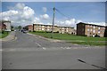
The property market in CV4 9GU is characterised by a housing stock defined by houses, with 34% of residents owning their homes outright. This ownership rate indicates that nearly one-third of the 1999 local residents are part of the owner-occupier class. If you are considering buying, you are entering a market where the accommodation type prioritises detached or semi-detached properties rather than apartments or flats. The small size of the area, spanning just 1.3 hectares, limits the total volume of properties available, meaning competition can be specific to individual listings rather than broad fluctuations in the wider Coventry market. For buyers, the implication of a 34% ownership rate is a mixed landscape where investment and long-term residence overlap. You are unlikely to find a massive number of rental-only halls of residence, suggesting a more stable neighbourhood composition. The presence of houses aligns with the area's transition from the Stoneleigh Estate to a suburban development, attracting those seeking traditional family homes. As you assess potential purchases in this postcode, remember that the housing stock is bounded by the ancient landmarks of Bockendon Grange Farm and historic church sites. The market here reflects the wider trend of Westwood Ward, where residential development respects the semi-rural character of the original countryside.
House Prices in CV4 9GU
Showing 1 properties
| Address | Type | Beds | Baths | Last Sale Price | Last Sale Date | |
|---|---|---|---|---|---|---|
| Severn Trent Laboratories, Torrington Avenue, Coventry, CV4 9GU | Industrial | - | - | - | - |
Energy Efficiency in CV4 9GU
Your daily lifestyle in CV4 9GU benefits from a diverse array of amenities located within practical reach of the residential cluster. Retail options are plentiful, with five key shopping outlets available. You will find Farmfoods Allesley and Budgens Jardine for essential groceryshopping, alongside the larger Costco Coventry which offers a wide range of household goods and electronics. These five retail locations ensure you can complete most shopping needs without long travel times. Transport options further enhance your convenience, as you can access five nearby rail stations including Tile Hill, Canley, and Berkswell. This rail network connects you to broader job markets and city centre leisure. For travel beyond the region, two Coventry Airports are located nearby, supporting residents who fly frequently. Living in CV4 9GU means balancing suburban quietness with urban accessibility. The presence of these amenities transforms the 1.3-hectare cluster into a well-serviced community hub. When you consider homes in CV4 9GU, the ease of reaching these shops and stations adds significant value to your daily routine.
Amenities
Schools
Families living in CV4 9GU have access to several educational institutions, though the immediate options are limited within the cluster itself. The closest facility to you is Finham Park 2. This institution is an academy with an Ofsted rating of good. While this single school is the most prominent option listed, the proximity to larger educational hubs in the wider Westwood Ward area provides alternatives for children of different ages. Living in CV4 9GU means that schooling decisions often require looking slightly beyond the immediate 1.3-hectare boundary, as the local cluster offers specific choices rather than a full-range of primary and secondary options. The good rating of Finham Park 2 suggests a standard of education that meets regulatory requirements, providing reassurance for parents. If you are researching schools near CV4 9GU, this academy represents a key starting point for your enquiries. The presence of an academy within reach aligns with the socioeconomic profile of the area, where education remains a central priority for residents raising children in the SW Coventry region. You should verify transport links to this school, as walking distances may extend beyond the dense residential zone into neighbouring wards.
| Rank | School | Type | Entry gender | Ages |
|---|
Explore more schools in this area
Go to Schools tabDemographics
The community inside CV4 9GU presents a clear demographic profile driven by a median age of 22 years. Adults aged between 30 and 64 years constitute the most common age range, indicating a population that spans from young professionals to established families. This mix supports a neighbourhood dynamic where energy and stability coexist. Home ownership stands at 34%, a figure that reflects a balance between private homeownership and renting within this specific postcode area. Consequently, you will encounter a mix of long-term residents and those occupying rental properties. The predominant ethnic group is White, which aligns with the broader demographic trends of the West Midlands region. The primary accommodation type in CV4 9GU consists of houses, distinguishing it from areas dominated by high-rise flats or terraced housing. This focus on houses provides a traditional suburban living environment for the 1999 residents currently living here. The population density reaches 158,785 people per square kilometre, a metric derived from the compact size of the 1.3-hectare area. While the density appears high on paper, the rural-to-suburban transition of Westwood Ward mitigates the feeling of overcrowding. You live among neighbours who share a connection to the area's history as a former heathland estate, fostering a sense of local identity within this dense residential cluster.
Household Size
Accommodation Type
Tenure
Ethnic Group
Religion
Household Composition
Age
Household Deprivation
NS-SEC
Explore more demographic insights in this area
Go to Demographics tabPlanning
Planning Constraints
- Flood RiskPremium
- Ramsar Wetland SitesPremium
- Area of Outstanding Natural BeautyPremium
- Protected Nature ReservePremium
- Protected WoodlandPremium