Area Overview for CV37 0HW
Photos of CV37 0HW
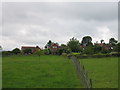
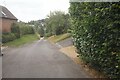
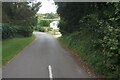
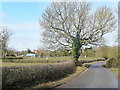
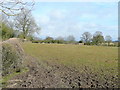
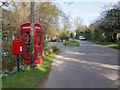
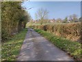
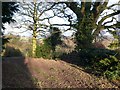
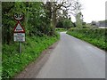
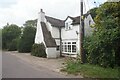
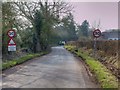
11 photos from this area
Area Information
Key information about the CV37 0HW including its size, population, and administrative classification.
- Area Type
- Postcode
- Area Size
- 1.2 km²
- Population
- 2290
- Population Density
- 93 people/km²
House Prices in CV37 0HW
23
Properties
£760,556
Average Sold Price
£285,000
Lowest Price
£2,685,000
Highest Price
Showing 23 properties
| Address | Type | Beds | Baths | Last Sale Price | Last Sale Date | |
|---|---|---|---|---|---|---|
| 1, Hillside Cottages, Spring Lane, Langley, CV37 0HW | house | - | - | £660,000 | Mar 2023 | |
| Harrow House, Main Street, Langley, CV37 0HW | Retail | 7 | 5 | £2,685,000 | Oct 2022 | |
| Spring Lane Cottage, Spring Lane, Langley, CV37 0HW | Detached | 3 | 2 | £700,000 | Oct 2019 | |
| Old Harrow, Spring Lane, Langley, CV37 0HW | house | 4 | 3 | £740,000 | Sep 2011 | |
| 2, Hillside Cottages, Spring Lane, Langley, CV37 0HW | Semi-detached | - | - | £440,000 | Mar 2008 | |
| Cornerways, Spring Lane, Langley, CV37 0HW | Detached | 4 | 3 | £595,000 | Aug 2006 | |
| High Barn House, Spring Lane, Langley, CV37 0HW | house | - | - | £425,000 | May 2001 | |
| Rose Barn House, Spring Lane, Langley, CV37 0HW | Semi-detached | - | - | £285,000 | Jul 1999 | |
| June Cottage, Spring Lane, Langley, CV37 0HW | Detached | 4 | 2 | £315,000 | Jul 1998 | |
| Lane End, Main Street, Langley, CV37 0HW | Detached | 4 | 3 | - | - |
Page 1 of 3
Energy Efficiency in CV37 0HW
Amenities
Schools
| Rank | School | Type | Entry gender | Ages |
|---|
Explore more schools in this area
Go to Schools tabDemographics
Household Size
Two person
most common
Accommodation Type
Houses
most common
Tenure
83
majority
Ethnic Group
White
most common
Religion
N/A
most common
Household Composition
N/A
most common
Age
47
median
Adults (30-64 years)
most common
Household Deprivation
N/A
with no deprivation
NS-SEC
49
in Lower managerial occupations
Explore more demographic insights in this area
Go to Demographics tabPlanning
Planning Constraints
- Flood RiskPremium
- Ramsar Wetland SitesPremium
- Area of Outstanding Natural BeautyPremium
- Protected Nature ReservePremium
- Protected WoodlandPremium