Area Overview for CV35 8PB
Photos of CV35 8PB
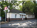
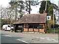
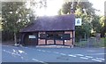
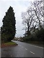
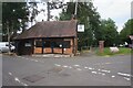
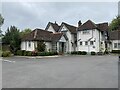

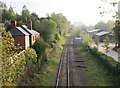
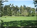
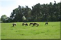
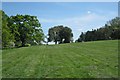
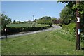
24 photos from this area
Area Information
Key information about the CV35 8PB including its size, population, and administrative classification.
- Area Type
- Postcode
- Area Size
- 55.5 hectares
- Population
- 2290
- Population Density
- 93 people/km²
House Prices in CV35 8PB
21
Properties
£816,654
Average Sold Price
£152,500
Lowest Price
£1,550,000
Highest Price
Showing 21 properties
| Address | Type | Beds | Baths | Last Sale Price | Last Sale Date | |
|---|---|---|---|---|---|---|
| Forge End, Church Road, Claverdon, CV35 8PB | house | - | - | £1,100,000 | Oct 2022 | |
| Windylea, Church Road, Claverdon, CV35 8PB | Detached | 5 | 2 | £1,550,000 | Jun 2022 | |
| 7 Church Road, Claverdon, CV35 8PB | Detached | 3 | 1 | £694,000 | Feb 2021 | |
| Church View, Church Road, Claverdon, CV35 8PB | house | 2 | - | £425,000 | Sep 2020 | |
| Newbury, Church Road, Claverdon, CV35 8PB | Bungalow | - | - | £585,000 | Apr 2014 | |
| Long Wood, Church Road, Claverdon, CV35 8PB | Detached | - | - | £407,500 | Aug 2011 | |
| 6 Church Road, Claverdon, CV35 8PB | house | - | - | £445,000 | Aug 2011 | |
| Hunters Hill, Church Road, Claverdon, CV35 8PB | Detached | - | - | £1,375,000 | Jul 2009 | |
| Arden Heights, Church Road, Claverdon, CV35 8PB | Detached | - | - | £1,175,000 | Nov 2008 | |
| Claverdon Fields, Church Road, Claverdon, CV35 8PB | house | - | - | £1,200,000 | Oct 2007 |
Page 1 of 3
Energy Efficiency in CV35 8PB
Amenities
Schools
| Rank | School | Type | Entry gender | Ages |
|---|
Explore more schools in this area
Go to Schools tabDemographics
Household Size
Two person
most common
Accommodation Type
Houses
most common
Tenure
83
majority
Ethnic Group
White
most common
Religion
N/A
most common
Household Composition
N/A
most common
Age
47
median
Adults (30-64 years)
most common
Household Deprivation
N/A
with no deprivation
NS-SEC
49
in Lower managerial occupations
Explore more demographic insights in this area
Go to Demographics tabPlanning
Planning Constraints
- Flood RiskPremium
- Ramsar Wetland SitesPremium
- Area of Outstanding Natural BeautyPremium
- Protected Nature ReservePremium
- Protected WoodlandPremium