Area Overview for CV35 8EX
Photos of CV35 8EX
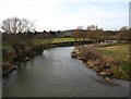
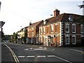
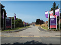
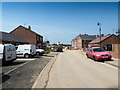
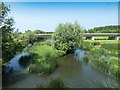
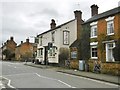
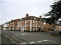
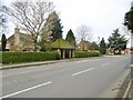
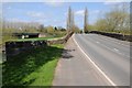
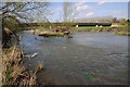
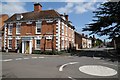
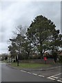
48 photos from this area
Area Information
Key information about the CV35 8EX including its size, population, and administrative classification.
- Area Type
- Postcode
- Area Size
- 8420 m²
- Population
- 2079
- Population Density
- 118 people/km²
House Prices in CV35 8EX
15
Properties
£361,290
Average Sold Price
£169,950
Lowest Price
£570,000
Highest Price
Showing 15 properties
| Address | Type | Beds | Baths | Last Sale Price | Last Sale Date | |
|---|---|---|---|---|---|---|
| 7 Wilkins Close, Barford, CV35 8EX | Detached | 4 | 2 | £450,000 | Mar 2025 | |
| 9 Wilkins Close, Barford, CV35 8EX | house | - | - | £505,000 | Nov 2019 | |
| 1 Wilkins Close, Barford, CV35 8EX | house | - | - | £570,000 | May 2018 | |
| 2B Wilkins Close, Barford, CV35 8EX | house | - | - | £247,500 | Sep 2014 | |
| 3 Wilkins Close, Barford, CV35 8EX | house | - | - | £370,000 | Apr 2009 | |
| 19 Wilkins Close, Barford, CV35 8EX | Detached | 4 | 2 | £362,500 | Aug 2008 | |
| 21 Wilkins Close, Barford, CV35 8EX | Detached | - | - | £380,000 | Oct 2007 | |
| 17 Wilkins Close, Barford, CV35 8EX | Detached | - | - | £295,000 | Apr 2005 | |
| 2 Wilkins Close, Barford, CV35 8EX | Detached | - | - | £262,950 | Jan 2003 | |
| 2A Wilkins Close, Barford, CV35 8EX | house | - | - | £169,950 | Nov 2001 |
Page 1 of 2
Energy Efficiency in CV35 8EX
Amenities
Schools
| Rank | School | Type | Entry gender | Ages |
|---|
Explore more schools in this area
Go to Schools tabDemographics
Household Size
Two person
most common
Accommodation Type
Houses
most common
Tenure
74
majority
Ethnic Group
White
most common
Religion
N/A
most common
Household Composition
N/A
most common
Age
47
median
Adults (30-64 years)
most common
Household Deprivation
N/A
with no deprivation
NS-SEC
53
in Lower managerial occupations
Explore more demographic insights in this area
Go to Demographics tabPlanning
Planning Constraints
- Flood RiskPremium
- Ramsar Wetland SitesPremium
- Area of Outstanding Natural BeautyPremium
- Protected Nature ReservePremium
- Protected WoodlandPremium