Area Overview for CV35 0UG
Photos of CV35 0UG
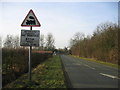
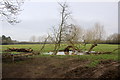
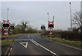
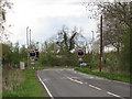
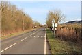
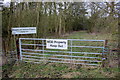
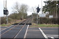
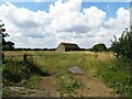

10 photos from this area
Area Information
Key information about the CV35 0UG including its size, population, and administrative classification.
- Area Type
- Postcode
- Area Size
- 2.3 km²
- Population
- 2338
- Population Density
- 52 people/km²
House Prices in CV35 0UG
35
Properties
£209,923
Average Sold Price
£72,500
Lowest Price
£285,500
Highest Price
Showing 35 properties
| Address | Type | Beds | Baths | Last Sale Price | Last Sale Date | |
|---|---|---|---|---|---|---|
| 27 The Green, Radway, CV35 0UG | Terraced | 2 | 1 | £200,000 | Mar 2025 | |
| 24 The Green, Radway, CV35 0UG | Terraced | 3 | 1 | £285,500 | Jan 2024 | |
| 26 The Green, Radway, CV35 0UG | Terraced | 2 | - | £215,000 | Oct 2018 | |
| Millstone Cottage, 6 The Green, Radway, CV35 0UG | Semi-detached | 3 | 1 | £276,153 | Oct 2017 | |
| 25 The Green, Radway, CV35 0UG | house | 2 | 1 | £205,000 | Oct 2015 | |
| 4 The Green, Radway, CV35 0UG | house | 3 | 1 | £245,000 | Mar 2014 | |
| 5 The Green, Radway, CV35 0UG | Semi-detached | 3 | 1 | £226,000 | Oct 2013 | |
| 11 The Green, Radway, CV35 0UG | house | - | - | £275,000 | Aug 2010 | |
| 1 The Green, Radway, CV35 0UG | house | - | - | £209,000 | Jul 2009 | |
| 8 The Green, Radway, CV35 0UG | Terraced | - | - | £72,500 | Oct 2002 |
Page 1 of 4
Energy Efficiency in CV35 0UG
Amenities
Schools
| Rank | School | Type | Entry gender | Ages |
|---|
Explore more schools in this area
Go to Schools tabDemographics
Household Size
Two person
most common
Accommodation Type
Houses
most common
Tenure
69
majority
Ethnic Group
White
most common
Religion
N/A
most common
Household Composition
N/A
most common
Age
47
median
Adults (30-64 years)
most common
Household Deprivation
N/A
with no deprivation
NS-SEC
46
in Lower managerial occupations
Explore more demographic insights in this area
Go to Demographics tabPlanning
Planning Constraints
- Flood RiskPremium
- Ramsar Wetland SitesPremium
- Area of Outstanding Natural BeautyPremium
- Protected Nature ReservePremium
- Protected WoodlandPremium