Area Overview for CV3 2JY
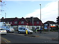
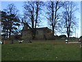
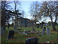
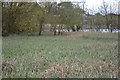
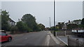
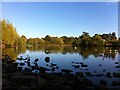
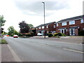
Photos of CV3 2JY

Area Information
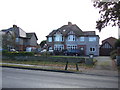
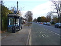
CV3 2JY is a small, densely populated residential area nestled in the south-eastern edge of Coventry, within the wards of Binley and Willenhall. Covering just 4,789 square metres, it is a compact cluster of homes with a population of 1,345 people, translating to a population density of over 280,000 per square kilometre. This area evolved from a historic mining village into a predominantly residential district, blending older council properties with private residences. The median age of 47 suggests a mature community, with 79% of residents owning their homes. Daily life here is shaped by proximity to Coventry’s urban core, with easy access to retail, transport, and green spaces. The area’s charm lies in its mix of historical roots—such as the 18th-century St Bartholomew’s Church—and modern convenience, including nearby supermarkets like Lidl Binley and Morrisons. Residents benefit from proximity to Coventry Airport and three railway stations, ensuring connectivity to the wider region. Despite its size, CV3 2JY offers a tight-knit community feel, with local landmarks like the Coombe Social Club and Brandon Wood serving as focal points for social and recreational activities.
- Area Type
- Postcode
- Area Size
- 4789 m²
- Population
- 1345
- Population Density
- 3381 people/km²
The property market in CV3 2JY is dominated by owner-occupied homes, with 79% of residents living in properties they own. This contrasts with areas where rental markets or shared ownership are more common. The accommodation type is primarily houses, reflecting a preference for detached or semi-detached properties over flats or apartments. Given the area’s small size—just 4,789 square metres—the housing stock is likely limited in volume, with properties concentrated in a compact cluster. This suggests that buyers should consider the limited availability of new builds or larger homes, particularly in a market where demand may outstrip supply. The presence of both private and council-owned properties indicates a mix of housing types, though the data does not specify the proportion of each. For those seeking a family home or long-term investment, the area’s stability and proximity to Coventry’s amenities may be appealing, though the small size of the postcode area means buyers must look beyond it for more extensive property options.
House Prices in CV3 2JY
Showing 12 properties
| Address | Type | Beds | Baths | Last Sale Price | Last Sale Date | |
|---|---|---|---|---|---|---|
| 12 Alvin Close, Coventry, CV3 2JY | house | - | - | £137,000 | Nov 2020 | |
| 3 Alvin Close, Coventry, CV3 2JY | Semi-detached | 2 | 1 | £152,000 | Jan 2020 | |
| 10 Alvin Close, Coventry, CV3 2JY | Semi-detached | 2 | 1 | £150,000 | Jun 2017 | |
| 7 Alvin Close, Coventry, CV3 2JY | Semi-detached | 2 | - | £110,000 | Oct 2014 | |
| 9 Alvin Close, Coventry, CV3 2JY | house | 3 | - | £126,000 | Jun 2011 | |
| 11 Alvin Close, Coventry, CV3 2JY | house | - | - | £119,950 | Apr 2006 | |
| 4 Alvin Close, Coventry, CV3 2JY | Semi-detached | - | - | £113,000 | Jun 2005 | |
| 6 Alvin Close, Coventry, CV3 2JY | Semi-detached | - | - | £69,500 | Oct 2002 | |
| 5 Alvin Close, Coventry, CV3 2JY | Detached | 3 | 1 | - | - | |
| 1 Alvin Close, Coventry, CV3 2JY | house | - | - | - | - |
Energy Efficiency in CV3 2JY
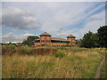
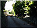
Living in CV3 2JY offers a blend of convenience and local character, with nearby amenities within practical reach. Retail options include Lidl Binley, Morrisons Binley, and Asda Living, providing essential shopping for groceries and household goods. For recreation, residents can access Brandon Wood, an ancient woodland managed by the Friends of Brandon Wood, and Willenhall Wood, a designated nature reserve. The area also features St Bartholomew’s Church, a grade I listed landmark, and the Coombe Social Club, which has served the community since 1929. A Village Green, established in 1989, hosts fêtes and family events, fostering a sense of community. The Binley Mega Chippy adds a local touch to dining options. While the area is small, its proximity to Coventry’s urban amenities—such as the Herald Way industrial estate and nearby schools—offers a balance between residential tranquillity and urban accessibility. This mix of green spaces, historical sites, and everyday conveniences creates a lifestyle that caters to both practical needs and a connection to local heritage.
Amenities
Schools
| Rank | School | Type | Entry gender | Ages |
|---|
Explore more schools in this area
Go to Schools tabDemographics
The community in CV3 2JY is predominantly composed of adults aged 30–64, with a median age of 47. This reflects a mature, stable population, with 79% of residents owning their homes—a figure significantly higher than the national average. The area is characterised by a high proportion of houses rather than flats, indicating a preference for family-friendly or long-term residential properties. The predominant ethnic group is White, though the data does not specify further diversity metrics. The high home ownership rate suggests a community with strong ties to the area, potentially contributing to a sense of permanence and local investment. However, the population density—over 280,000 people per square kilometre—raises questions about spatial constraints and the availability of communal spaces. While the data does not quantify deprivation levels, the concentration of residential properties and the absence of large-scale commercial developments imply a focus on private living over shared or mixed-use environments.
Household Size
Accommodation Type
Tenure
Ethnic Group
Religion
Household Composition
Age
Household Deprivation
NS-SEC
Explore more demographic insights in this area
Go to Demographics tabPlanning
Planning Constraints
- Flood RiskPremium
- Ramsar Wetland SitesPremium
- Area of Outstanding Natural BeautyPremium
- Protected Nature ReservePremium
- Protected WoodlandPremium