Area Overview for CV3 1NZ
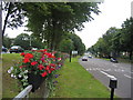
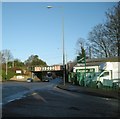
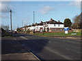
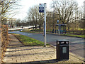
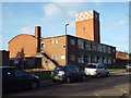
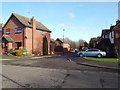
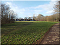
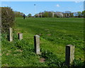
Photos of CV3 1NZ


Area Information
Living in CV3 1NZ means inhabiting a tightly packed residential cluster in Lower Stoke Ward, Coventry. This small postcode area, spanning 8,777 m², is home to 2,799 people, creating a high population density of 318,917 per km². The area straddles the Coventry-Rugby railway line, with newer housing developments to the north replacing former industrial sites like the Humber and Peugeot factories. To the south, older light industrial estates and offices remain, reflecting the area’s 20th-century car manufacturing heritage. Residents benefit from proximity to Coventry city centre, with easy access to rail networks and two nearby airports. Daily life here is shaped by a mix of practical amenities, including retail outlets like Co-op Humber and Asda Abbey, and a strong rail connection to Tile Hill and Coventry Arena stations. The community, predominantly White and centred around adults aged 30–64, reflects a mature demographic with a focus on stability. While the area’s history is steeped in industry, its modern character is defined by compact housing and a network of local services that cater to both daily needs and regional connectivity.
- Area Type
- Postcode
- Area Size
- 8777 m²
- Population
- Not available
- Population Density
- Not available
The property market in CV3 1NZ is characterised by a 50% home ownership rate, with houses forming the predominant accommodation type. This suggests a mix of owner-occupied properties and rental units, though the exact proportion of rentals is not specified. The area’s housing stock reflects its dual legacy: newer developments to the north, built on former industrial land, and older homes in the southern industrial zones. Given the small area size and high population density, properties are likely to be compact, with limited space for larger family homes. For buyers, this means a focus on smaller, practical housing that suits the area’s layout. The redevelopment of former car manufacturing sites into residential areas indicates potential for modern, purpose-built homes, though existing properties may retain industrial-era features. Prospective buyers should consider the proximity to rail networks and the area’s blend of housing types when evaluating long-term value and suitability for their needs.
House Prices in CV3 1NZ
Showing 38 properties
| Address | Type | Beds | Baths | Last Sale Price | Last Sale Date | |
|---|---|---|---|---|---|---|
| 219 Humber Road, Coventry, CV3 1NZ | Terraced | 2 | 2 | £188,000 | Jun 2025 | |
| 189 Humber Road, Coventry, CV3 1NZ | Semi-detached | 3 | 2 | £278,500 | Apr 2025 | |
| 205 Humber Road, Coventry, CV3 1NZ | house | 3 | 2 | £215,000 | Mar 2025 | |
| 217 Humber Road, Coventry, CV3 1NZ | Terraced | 3 | 1 | £249,000 | Nov 2024 | |
| 225 Humber Road, Coventry, CV3 1NZ | Terraced | 2 | 1 | £202,500 | Oct 2024 | |
| 171 Humber Road, Coventry, CV3 1NZ | Semi-detached | 4 | 1 | £305,000 | Oct 2023 | |
| 215 Humber Road, Coventry, CV3 1NZ | house | 4 | 2 | £260,000 | Sep 2023 | |
| 195 Humber Road, Coventry, CV3 1NZ | Semi-detached | 3 | 2 | £246,000 | Jul 2022 | |
| 155 Humber Road, Coventry, CV3 1NZ | Semi-detached | 4 | 2 | £290,000 | Jan 2022 | |
| 223 Humber Road, Coventry, CV3 1NZ | house | - | - | £255,000 | Oct 2021 |
Energy Efficiency in CV3 1NZ
Residents of CV3 1NZ have access to a range of practical amenities within walking or short driving distance. The area’s retail options include Co-op Humber, Asda Abbey, and Budgens Aldermoor, providing essential shopping and grocery needs. While there are no major parks or leisure facilities listed, the proximity to rail stations and airports opens up broader regional opportunities for recreation and dining. The character of the area—blending older industrial infrastructure with newer housing—means that daily life is shaped by a pragmatic, utilitarian approach to living. The rail network offers frequent services to Coventry’s cultural and commercial centres, while the nearby airports cater to those requiring regional or international travel. For residents, the combination of retail outlets and transport links ensures convenience, though the area’s compact nature may limit access to large-scale leisure amenities.
Amenities
Schools
| Rank | School | Type | Entry gender | Ages |
|---|
Explore more schools in this area
Go to Schools tabDemographics
CV3 1NZ has a median age of 47, with the majority of residents falling within the 30–64 age range. This suggests a community of established professionals and families, many of whom may have ties to nearby industrial or commercial sectors. Home ownership rates are 50%, indicating a balance between owner-occupied properties and rental housing. The area’s accommodation is primarily houses, which, combined with the high population density, implies a mix of smaller, closely spaced dwellings. The predominant ethnic group is White, reflecting the broader demographic trends of the West Midlands region. The high population density, while facilitating a sense of community, may also contribute to a compact, sometimes crowded living environment. For residents, this density means proximity to amenities and transport links but also potential challenges in finding larger properties. The data does not indicate specific deprivation levels, but the demographic profile suggests a stable, working-age population with established roots in the area.
Household Size
Accommodation Type
Tenure
Ethnic Group
Religion
Household Composition
Age
Household Deprivation
NS-SEC
Explore more demographic insights in this area
Go to Demographics tabPlanning
Planning Constraints
- Flood RiskPremium
- Ramsar Wetland SitesPremium
- Area of Outstanding Natural BeautyPremium
- Protected Nature ReservePremium
- Protected WoodlandPremium