Area Overview for CV3 1LL
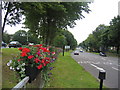
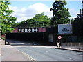
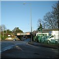
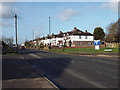
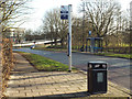
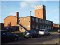
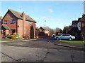
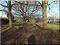
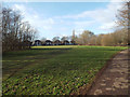
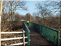
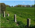
Photos of CV3 1LL

Area Information
CV3 1LL is a small, densely populated residential cluster in Coventry, England, covering just 2.6 hectares and home to 2,044 people. Its high population density of 77,679 people per square kilometre reflects a compact, urban character. The area sits within Lower Stoke Ward, historically shaped by industrial activity, including former car manufacturing sites that have since been redeveloped into housing. Today, it is a young community, with a median age of 22 and a majority of residents aged 15–29. This demographic suggests a dynamic, possibly student- or young professional-driven population. The area is well-connected to Coventry’s city centre and beyond via rail links, and its proximity to educational institutions and retail hubs makes it practical for daily life. While the landscape is defined by recent housing and light industry, the area’s compact size means amenities and services are within close reach, blending convenience with the legacy of its industrial past.
- Area Type
- Postcode
- Area Size
- 2.6 hectares
- Population
- 2044
- Population Density
- 5842 people/km²
The property market in CV3 1LL is characterised by a low home ownership rate of 21%, suggesting that the majority of residents rent their homes. The accommodation type is primarily houses, though the area’s small size and high density imply these are likely smaller, possibly older properties. The redevelopment of former industrial sites into housing has shaped the current stock, with a mix of newer builds and conversions. For buyers, the limited housing stock means competition is likely, and options may be constrained to the immediate area. The predominance of houses over flats or apartments may appeal to those seeking more space, but the area’s compact nature means proximity to amenities is both a benefit and a limitation. Investors should consider the transient nature of the population, which may affect long-term value.
House Prices in CV3 1LL
No properties found in this postcode.
Energy Efficiency in CV3 1LL
The lifestyle in CV3 1LL is shaped by its proximity to retail, transport, and light industry. Five retail outlets, including Asda Abbey and Co-op Humber, are within practical reach, offering everyday shopping convenience. The area’s rail network, with stations like Tile Hill and Canley, connects residents to Coventry’s cultural and economic hubs. While there are no parks or green spaces listed, the historical industrial legacy is evident in the presence of former car manufacturing sites now repurposed for housing and offices. The compact nature of the area means amenities are close, though the lack of dedicated leisure facilities may require travel to nearby neighbourhoods. The mix of retail, transport, and light industry creates a practical, functional environment, ideal for those prioritising accessibility over expansive recreational spaces.
Amenities
Schools
Nearby schools include Gosford Park Primary School, which has an Ofsted rating of satisfactory, and The Coventry Blue Coat Church of England School and Music College, a primary school without a specified rating. Blue Coat Church of England School and Music College, an academy, holds a good Ofsted rating. The mix of primary schools and an academy provides families with options, though the absence of a rating for one school may raise questions about its performance. The presence of a rated good academy suggests at least one institution offers a strong educational standard. Families should consider the proximity of these schools to specific properties and the potential impact of school catchment areas on property value. The overall range of school types may cater to different educational preferences, though the data does not indicate specialist provision beyond primary education.
| Rank | School | Type | Entry gender | Ages |
|---|
Explore more schools in this area
Go to Schools tabDemographics
The population of CV3 1LL is overwhelmingly young, with a median age of 22 and 78% of residents falling within the 15–29 age range. This suggests a community dominated by students, young professionals, or those starting families. Home ownership is low at 21%, indicating that most residents are renters, likely due to the area’s small size and limited housing stock. The predominant accommodation type is houses, though the high population density implies these are often smaller properties. The ethnic composition is predominantly White, with no specific data on other groups. The age profile and ownership figures suggest a transient population, possibly influenced by nearby educational institutions or employment opportunities. The area’s compact nature and young demographic may create a lively, fast-paced environment, though it may also mean limited long-term community stability.
Household Size
Accommodation Type
Tenure
Ethnic Group
Religion
Household Composition
Age
Household Deprivation
NS-SEC
Explore more demographic insights in this area
Go to Demographics tabPlanning
Planning Constraints
- Flood RiskPremium
- Ramsar Wetland SitesPremium
- Area of Outstanding Natural BeautyPremium
- Protected Nature ReservePremium
- Protected WoodlandPremium