Area Overview for CV3 1EN
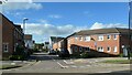
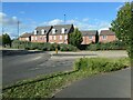
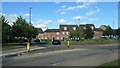
Photos of CV3 1EN


Area Information
CV3 1EN is a compact residential postcode in England, covering just 5 hectares and home to 1532 people. Its density—30,782 people per square kilometre—reflects a tightly knit community, though the area’s small size means it is more of a cluster than a sprawling suburb. Situated in Lower Stoke Ward, near Coventry’s southern edge, it lies north of the Coventry-Rugby railway line, with a mix of newer housing developments and older industrial zones. The area’s history is rooted in car manufacturing, with remnants of former factories like the Humber and Peugeot plants now replaced by residential blocks. Daily life here balances proximity to Coventry’s city centre with a quieter, more localised feel. Residents benefit from nearby retail outlets, rail links, and schools, while the area’s compact nature means most amenities are within walking or cycling distance. The postcode’s character is defined by its industrial past and recent redevelopment, creating a unique blend of practicality and community focus.
- Area Type
- Postcode
- Area Size
- 5.0 hectares
- Population
- 1532
- Population Density
- 6550 people/km²
The property market in CV3 1EN is characterised by a 34% home ownership rate, suggesting that a majority of residents rent rather than own their homes. This could indicate a rental market driven by the area’s industrial history and the availability of older properties. The accommodation type is predominantly houses, which may cater to families or individuals seeking more space than flats. However, the small size of the postcode—just 5 hectares—means the housing stock is limited, and buyers may need to look beyond the immediate area for more options. Recent redevelopment north of the Coventry-Rugby railway line has introduced newer housing, but the overall market remains constrained by the postcode’s compact nature. For buyers, this means competition for available properties and a need to consider nearby areas for larger selections.
House Prices in CV3 1EN
Showing 57 properties
| Address | Type | Beds | Baths | Last Sale Price | Last Sale Date | |
|---|---|---|---|---|---|---|
| 18 The Coppice, Coventry, CV3 1EN | Semi-detached | 7 | 2 | £165,000 | Aug 2019 | |
| 28 The Coppice, Coventry, CV3 1EN | Semi-detached | 3 | 1 | £130,000 | Aug 2017 | |
| 70 The Coppice, Coventry, CV3 1EN | house | - | - | £113,000 | Mar 2016 | |
| 102 The Coppice, Coventry, CV3 1EN | house | - | - | £90,000 | Feb 2013 | |
| 74 The Coppice, Coventry, CV3 1EN | house | - | - | £68,000 | Dec 2011 | |
| 92 The Coppice, Coventry, CV3 1EN | Terraced | - | - | £94,000 | Aug 2006 | |
| 108 The Coppice, Coventry, CV3 1EN | Terraced | - | - | £65,000 | Jul 2004 | |
| 86 The Coppice, Coventry, CV3 1EN | Semi-detached | - | - | £60,000 | Oct 2003 | |
| 54 The Coppice, Coventry, CV3 1EN | Semi-detached | - | - | £44,000 | Sep 2002 | |
| 100 The Coppice, Coventry, CV3 1EN | house | - | - | £25,000 | Aug 2002 |
Energy Efficiency in CV3 1EN
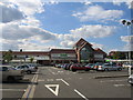
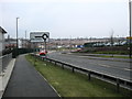
The lifestyle in CV3 1EN is shaped by its proximity to retail, transport, and light industry. Within practical reach are five retail outlets, including Budgens Aldermoor and Asda Abbey, offering everyday shopping needs. The area’s rail links—five stations in total—provide access to Coventry’s city centre and further afield, while two airports, both named Coventry Airport, suggest potential for regional travel. Though the postcode’s small size limits large-scale leisure options, its industrial heritage and recent housing developments create a functional, community-focused environment. The mix of retail and transport amenities supports a practical daily life, though the absence of major parks or cultural venues means residents may need to venture further for broader leisure activities.
Amenities
Schools
The nearest school to CV3 1EN is Aldermoor Farm Junior School, a primary institution serving the local community. No secondary schools are listed in the data, meaning families may need to look beyond the postcode for comprehensive education. The presence of a primary school suggests that the area is suitable for young children, though the absence of secondary options could be a consideration for families planning long-term. The school’s type and performance are not specified, so further research would be necessary to assess its quality. Overall, the educational infrastructure in CV3 1EN is basic, with primary schooling available but secondary options requiring a broader search.
| Rank | School | Type | Entry gender | Ages |
|---|
Explore more schools in this area
Go to Schools tabDemographics
The population of CV3 1EN has a median age of 47, with the majority of residents aged between 30 and 64. This suggests a mature, stable community, likely with established careers and family structures. Home ownership stands at 34%, indicating a significant proportion of residents rent their homes, possibly due to the area’s mix of older properties and newer developments. The primary accommodation type is houses, which aligns with the postcode’s residential focus. The predominant ethnic group is White, though specific data on diversity or deprivation is not provided. The age profile implies a community that may prioritise stability over transient lifestyles, with fewer young families compared to areas with higher birth rates. The relatively low home ownership rate could also reflect the area’s industrial heritage, where rental properties may have historically been more common.
Household Size
Accommodation Type
Tenure
Ethnic Group
Religion
Household Composition
Age
Household Deprivation
NS-SEC
Explore more demographic insights in this area
Go to Demographics tabPlanning
Planning Constraints
- Flood RiskPremium
- Ramsar Wetland SitesPremium
- Area of Outstanding Natural BeautyPremium
- Protected Nature ReservePremium
- Protected WoodlandPremium