Area Overview for CV3 1EL
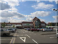
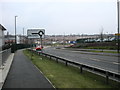
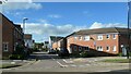
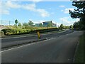
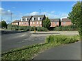
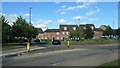
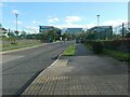
Photos of CV3 1EL


Area Information
CV3 1EL is a compact residential postcode in Coventry’s Lower Stoke Ward, home to 1,532 people spread across 8,438 square metres. This densely populated area, situated to the south-east of Coventry city centre, reflects a blend of recent housing developments and historical industrial roots. The community is predominantly composed of adults aged 30–64, with a median age of 47, suggesting a stable, mature demographic. The area’s character is shaped by its proximity to the Coventry-Rugby railway line and the remnants of 20th-century car manufacturing sites, now redeveloped for housing. While the northern part features newer homes, the southern side retains light industrial estates and offices. Living here offers a mix of convenience and history, with easy access to rail networks and proximity to the city’s core. The high population density means the area feels tightly knit, though the lack of green spaces or historic landmarks may appeal to those prioritising practicality over heritage.
- Area Type
- Postcode
- Area Size
- 8438 m²
- Population
- 1532
- Population Density
- 6550 people/km²
The property market in CV3 1EL is characterised by a 34% home ownership rate, with houses being the primary accommodation type. This suggests a modest market where owner-occupied homes are less common than in other areas, potentially indicating a higher proportion of rental properties. The small area size and high population density mean housing stock is limited, with redevelopment focused on the northern side, replacing former industrial sites. The southern part retains light industrial estates and offices, which may influence property values and availability. For buyers, this means competition for homes could be keen, particularly for newer developments. The presence of both residential and industrial zones may also affect property desirability, with potential noise or traffic concerns near the railway line.
House Prices in CV3 1EL
Showing 41 properties
| Address | Type | Beds | Baths | Last Sale Price | Last Sale Date | |
|---|---|---|---|---|---|---|
| 9A The Coppice, Coventry, CV3 1EL | Flat | - | - | £85,000 | Jun 2024 | |
| 23A The Coppice, Coventry, CV3 1EL | Flat | 1 | 1 | £71,630 | Aug 2020 | |
| 25A The Coppice, Coventry, CV3 1EL | Flat | 1 | 1 | £70,000 | Oct 2019 | |
| 35 The Coppice, Coventry, CV3 1EL | Terraced | 3 | 1 | £146,000 | Apr 2018 | |
| 21A The Coppice, Coventry, CV3 1EL | Flat | 2 | 2 | £50,000 | Oct 2017 | |
| 3 The Coppice, Coventry, CV3 1EL | Flat | - | - | £59,500 | Mar 2016 | |
| 33 The Coppice, Coventry, CV3 1EL | house | - | - | £66,500 | Jun 2011 | |
| 29 The Coppice, Coventry, CV3 1EL | Flat | 1 | 1 | £105,000 | Oct 2005 | |
| 63 The Coppice, Coventry, CV3 1EL | house | - | - | £45,000 | Jun 2002 | |
| 77 The Coppice, Coventry, CV3 1EL | Flat | 1 | 1 | - | - |
Energy Efficiency in CV3 1EL
The lifestyle in CV3 1EL is shaped by its proximity to retail, transport, and industrial zones. Five retail outlets, including Budgens Aldermoor, Asda Abbey, and Heron Willenhall, provide everyday shopping convenience. While the area lacks dedicated leisure or green spaces, its rail connections offer easy access to Coventry’s cultural and recreational offerings. The presence of two airports and multiple train stations enhances mobility, making it practical for both daily commutes and regional travel. The mix of retail and transport infrastructure suggests a functional, service-oriented community, though the lack of parks or public spaces may appeal more to those prioritising accessibility over leisure.
Amenities
Schools
The nearest school to CV3 1EL is Aldermoor Farm Junior School, a primary institution serving the local community. No secondary schools are listed in the data, so families with older children may need to look beyond the immediate area for comprehensive education. The presence of a primary school suggests the area is suitable for young families, though the absence of secondary options could be a consideration for those planning long-term stays. The school’s type and performance are not detailed, but its existence indicates some local investment in education. Parents should verify additional school options nearby to ensure a full range of educational needs are met.
| Rank | School | Type | Entry gender | Ages |
|---|
Explore more schools in this area
Go to Schools tabDemographics
The population of CV3 1EL is 1,532, with a median age of 47 and the majority of residents aged 30–64. This suggests a community of established professionals and families, with fewer young adults or retirees. Home ownership stands at 34%, indicating a mix of owner-occupied and rental properties, though the lower percentage suggests a significant portion of residents may be renting. The predominant accommodation type is houses, which, combined with the high population density, implies smaller, closely spaced properties. The predominant ethnic group is White, with no data provided on other ethnicities or diversity metrics. The age profile and home ownership rate suggest a stable, middle-aged population with a focus on long-term residency. However, the lack of data on deprivation or income levels means the area’s economic challenges remain unquantified.
Household Size
Accommodation Type
Tenure
Ethnic Group
Religion
Household Composition
Age
Household Deprivation
NS-SEC
Explore more demographic insights in this area
Go to Demographics tabPlanning
Planning Constraints
- Flood RiskPremium
- Ramsar Wetland SitesPremium
- Area of Outstanding Natural BeautyPremium
- Protected Nature ReservePremium
- Protected WoodlandPremium