Area Overview for CV2 2SW
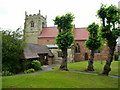
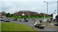
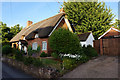
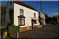
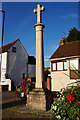
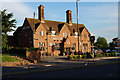
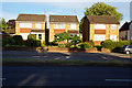
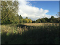
Photos of CV2 2SW


Area Information
CV2 2SW is a small residential postcode area in England, covering just 1.6 hectares and home to 1,336 residents. Its compact size means it is densely populated, with 976 people per square kilometre, creating a tightly knit community. The area is predominantly occupied by adults aged 30–64, with a median age of 47, suggesting a mature demographic profile. Most residents own their homes, with 52% of properties in private ownership, and the majority live in houses rather than flats. This mix of home ownership and family-focused living shapes a stable, localised environment. While the area lacks detailed historical or cultural descriptors, its proximity to Coventry’s infrastructure, including multiple railway stations and retail hubs, ensures practical connectivity. Daily life here is likely characterised by routine access to nearby amenities, though the absence of specific landmarks or parks means the area’s identity remains largely defined by its functional, residential purpose. For buyers, CV2 2SW offers a small, established community with straightforward access to essential services, though its limited size may restrict opportunities for expansion or development.
- Area Type
- Postcode
- Area Size
- 1.6 hectares
- Population
- 1336
- Population Density
- 976 people/km²
The property market in CV2 2SW is characterised by a high proportion of owner-occupied homes, with 52% of properties in private hands. This suggests a stable, long-term resident base rather than a transient rental market. The accommodation type is predominantly houses, which is unusual for smaller urban areas and may indicate a preference for single-family living. Given the area’s small size (1.6 hectares), the housing stock is likely limited, with little scope for new developments or additional properties. For buyers, this means competition for existing homes and a focus on the condition and location of individual properties. The proximity to Coventry’s transport links and retail amenities may enhance the appeal of homes in this area, though the lack of detailed data on property prices or trends makes it difficult to assess market dynamics beyond ownership patterns.
House Prices in CV2 2SW
No properties found in this postcode.
Energy Efficiency in CV2 2SW
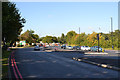
Residents of CV2 2SW have access to a range of nearby amenities, including five retail outlets such as M&S University Hospital Coventry, Co-op Woodway, and Tesco Coventry. These shops provide everyday convenience, from grocery shopping to general retail. The area’s proximity to four railway stations and two airports enhances mobility, though the specific destinations or routes are not detailed. The absence of named parks or leisure facilities means recreational options may be limited to nearby public spaces or community centres. The compact nature of the area means amenities are likely clustered closely, offering a mix of practicality and convenience for daily life. However, the lack of specific landmarks or cultural venues suggests a focus on functional, service-oriented living rather than leisure-driven amenities.
Amenities
Schools
The only named school near CV2 2SW is Coventry Hospital School and Home Tuition Service, which is categorised as an ‘other’ type of institution. No specific Ofsted rating is provided, so its educational quality cannot be assessed from the data. The absence of other schools, particularly primary or secondary institutions, may be a concern for families seeking a range of educational options. The single listed school suggests limited local provision, which could necessitate reliance on nearby schools in adjacent areas. For parents, this highlights the importance of researching additional educational facilities beyond CV2 2SW’s immediate boundaries, as the area’s small size may not support a comprehensive school network.
| Rank | School | Type | Entry gender | Ages |
|---|
Explore more schools in this area
Go to Schools tabDemographics
The population of CV2 2SW is 1,336, with a median age of 47 and a majority of residents aged between 30 and 64. This suggests a community of working-age adults, likely focused on family life or long-term residency. Home ownership is strong, with 52% of properties privately owned, indicating a degree of stability and investment in the area. The predominant accommodation type is houses, which aligns with the demographic profile of older, family-oriented households. The population density of 976 people per square kilometre reflects a compact, closely spaced residential cluster, which may influence social dynamics and local services. The predominant ethnic group is White, though specific data on diversity or deprivation is not provided. The high proportion of owner-occupied homes and the absence of detailed socioeconomic breakdowns suggest a relatively uniform community, though the small area size may limit the range of household types present.
Household Size
Accommodation Type
Tenure
Ethnic Group
Religion
Household Composition
Age
Household Deprivation
NS-SEC
Explore more demographic insights in this area
Go to Demographics tabPlanning
Planning Constraints
- Flood RiskPremium
- Ramsar Wetland SitesPremium
- Area of Outstanding Natural BeautyPremium
- Protected Nature ReservePremium
- Protected WoodlandPremium