Area Overview for CV2 2QA
Photos of CV2 2QA
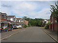
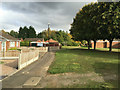
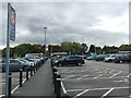
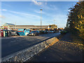
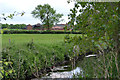
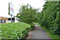
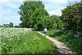
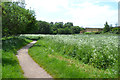
43 photos from this area
Area Information
Key information about the CV2 2QA including its size, population, and administrative classification.
- Area Type
- Postcode
- Area Size
- 2.1 hectares
- Population
- Not available
- Population Density
- Not available
House Prices in CV2 2QA
14
Properties
£134,417
Average Sold Price
£50,500
Lowest Price
£310,000
Highest Price
Showing 14 properties
| Address | Type | Beds | Baths | Last Sale Price | Last Sale Date | |
|---|---|---|---|---|---|---|
| 71 Dorchester Way, Coventry, CV2 2QA | house | - | - | £94,000 | Mar 2025 | |
| 63 Dorchester Way, Coventry, CV2 2QA | Semi-detached | 4 | 2 | £310,000 | Feb 2025 | |
| 69 Dorchester Way, Coventry, CV2 2QA | Terraced | 3 | 1 | £138,000 | Sep 2014 | |
| 73 Dorchester Way, Coventry, CV2 2QA | house | 3 | - | £138,000 | Dec 2011 | |
| 83 Dorchester Way, Coventry, CV2 2QA | Terraced | - | - | £76,000 | Mar 2002 | |
| 67 Dorchester Way, Coventry, CV2 2QA | Terraced | 3 | 1 | £50,500 | Nov 1998 | |
| 79 Dorchester Way, Coventry, CV2 2QA | Terraced | - | - | - | - | |
| 75 Dorchester Way, Coventry, CV2 2QA | Terraced | - | - | - | - | |
| 61 Dorchester Way, Coventry, CV2 2QA | Semi-detached | - | - | - | - | |
| 57 Dorchester Way, Coventry, CV2 2QA | Semi-detached | - | - | - | - |
Page 1 of 2
Energy Efficiency in CV2 2QA
Amenities
Schools
| Rank | School | Type | Entry gender | Ages |
|---|
Explore more schools in this area
Go to Schools tabDemographics
Household Size
Family (3-5 people)
most common
Accommodation Type
Houses
most common
Tenure
80
majority
Ethnic Group
White
most common
Religion
N/A
most common
Household Composition
N/A
most common
Age
47
median
Adults (30-64 years)
most common
Household Deprivation
N/A
with no deprivation
NS-SEC
33
in Lower managerial occupations
Explore more demographic insights in this area
Go to Demographics tabPlanning
Planning Constraints
- Flood RiskPremium
- Ramsar Wetland SitesPremium
- Area of Outstanding Natural BeautyPremium
- Protected Nature ReservePremium
- Protected WoodlandPremium