Area Overview for CV11 6DZ
Photos of CV11 6DZ
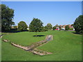
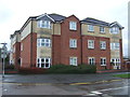
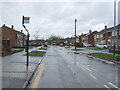
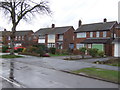
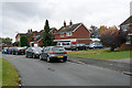
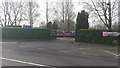
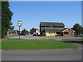

13 photos from this area
Area Information
Key information about the CV11 6DZ including its size, population, and administrative classification.
- Area Type
- Postcode
- Area Size
- 8586 m²
- Population
- 1404
- Population Density
- 2376 people/km²
House Prices in CV11 6DZ
19
Properties
£160,493
Average Sold Price
£74,950
Lowest Price
£310,000
Highest Price
Showing 19 properties
| Address | Type | Beds | Baths | Last Sale Price | Last Sale Date | |
|---|---|---|---|---|---|---|
| 79 St Nicolas Park Drive, Nuneaton, CV11 6DZ | Detached | 3 | 1 | £310,000 | Apr 2023 | |
| 73 St Nicolas Park Drive, Nuneaton, CV11 6DZ | house | - | - | £222,000 | Jul 2021 | |
| 93 St Nicolas Park Drive, Nuneaton, CV11 6DZ | Semi-detached | 3 | 1 | £235,000 | Oct 2020 | |
| 83 St Nicolas Park Drive, Nuneaton, CV11 6DZ | Semi-detached | 3 | 1 | £235,000 | Oct 2020 | |
| 95 St Nicolas Park Drive, Nuneaton, CV11 6DZ | house | - | - | £115,000 | Dec 2018 | |
| 87 St Nicolas Park Drive, Nuneaton, CV11 6DZ | Detached | 3 | 1 | £255,000 | Jul 2018 | |
| 77 St Nicolas Park Drive, Nuneaton, CV11 6DZ | Detached | 3 | 1 | £192,000 | Mar 2009 | |
| 89 St Nicolas Park Drive, Nuneaton, CV11 6DZ | Detached | - | - | £175,000 | Dec 2003 | |
| 85 St Nicolas Park Drive, Nuneaton, CV11 6DZ | house | - | - | £104,000 | Dec 2001 | |
| 75 St Nicolas Park Drive, Nuneaton, CV11 6DZ | Semi-detached | - | - | £81,500 | May 1999 |
Page 1 of 2
Energy Efficiency in CV11 6DZ
Amenities
Schools
| Rank | School | Type | Entry gender | Ages |
|---|
Explore more schools in this area
Go to Schools tabDemographics
Household Size
Two person
most common
Accommodation Type
Houses
most common
Tenure
93
majority
Ethnic Group
White
most common
Religion
N/A
most common
Household Composition
N/A
most common
Age
47
median
Elderly (65+ years)
most common
Household Deprivation
N/A
with no deprivation
NS-SEC
37
in Lower managerial occupations
Explore more demographic insights in this area
Go to Demographics tabPlanning
Planning Constraints
- Flood RiskPremium
- Ramsar Wetland SitesPremium
- Area of Outstanding Natural BeautyPremium
- Protected Nature ReservePremium
- Protected WoodlandPremium