Area Overview for CV11 6DY
Photos of CV11 6DY
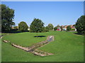
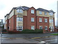
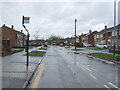
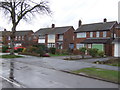
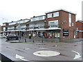
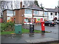
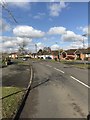
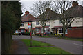
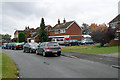
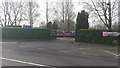
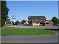
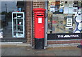
13 photos from this area
Area Information
Key information about the CV11 6DY including its size, population, and administrative classification.
- Area Type
- Postcode
- Area Size
- 9143 m²
- Population
- 1596
- Population Density
- 1138 people/km²
House Prices in CV11 6DY
29
Properties
£205,722
Average Sold Price
£58,500
Lowest Price
£400,000
Highest Price
Showing 29 properties
| Address | Type | Beds | Baths | Last Sale Price | Last Sale Date | |
|---|---|---|---|---|---|---|
| 94 St Nicolas Park Drive, Nuneaton, CV11 6DY | Semi-detached | 4 | 1 | £319,500 | Apr 2024 | |
| 96 St Nicolas Park Drive, Nuneaton, CV11 6DY | house | - | - | £314,000 | Nov 2022 | |
| 104 St Nicolas Park Drive, Nuneaton, CV11 6DY | Detached | 5 | 2 | £400,000 | Apr 2022 | |
| 92 St Nicolas Park Drive, Nuneaton, CV11 6DY | house | - | - | £302,500 | Sep 2021 | |
| 108 St Nicolas Park Drive, Nuneaton, CV11 6DY | house | 3 | - | £151,438 | Dec 2019 | |
| 100 St Nicolas Park Drive, Nuneaton, CV11 6DY | house | - | - | £182,500 | Feb 2014 | |
| 112 St Nicolas Park Drive, Nuneaton, CV11 6DY | house | - | - | £178,000 | May 2012 | |
| 116 St Nicolas Park Drive, Nuneaton, CV11 6DY | house | - | - | £185,000 | Jun 2009 | |
| 106 St Nicolas Park Drive, Nuneaton, CV11 6DY | house | - | - | £234,000 | Jun 2006 | |
| 90 St Nicolas Park Drive, Nuneaton, CV11 6DY | Semi-detached | - | - | £170,000 | Jan 2005 |
Page 1 of 3
Energy Efficiency in CV11 6DY
Amenities
Schools
| Rank | School | Type | Entry gender | Ages |
|---|
Explore more schools in this area
Go to Schools tabDemographics
Household Size
Two person
most common
Accommodation Type
Houses
most common
Tenure
89
majority
Ethnic Group
White
most common
Religion
N/A
most common
Household Composition
N/A
most common
Age
47
median
Adults (30-64 years)
most common
Household Deprivation
N/A
with no deprivation
NS-SEC
42
in Lower managerial occupations
Explore more demographic insights in this area
Go to Demographics tabPlanning
Planning Constraints
- Flood RiskPremium
- Ramsar Wetland SitesPremium
- Area of Outstanding Natural BeautyPremium
- Protected Nature ReservePremium
- Protected WoodlandPremium