Area Overview for CV10 0LA
Photos of CV10 0LA
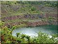
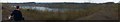
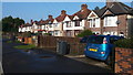
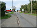
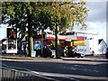
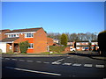
6 photos from this area
Area Information
Key information about the CV10 0LA including its size, population, and administrative classification.
- Area Type
- Postcode
- Area Size
- 8346 m²
- Population
- 2062
- Population Density
- 2569 people/km²
House Prices in CV10 0LA
19
Properties
£170,308
Average Sold Price
£65,000
Lowest Price
£310,000
Highest Price
Showing 19 properties
| Address | Type | Beds | Baths | Last Sale Price | Last Sale Date | |
|---|---|---|---|---|---|---|
| 16 Berrington Road, Nuneaton, CV10 0LA | Semi-detached | 3 | 2 | £235,000 | Jul 2024 | |
| 4 Berrington Road, Nuneaton, CV10 0LA | Semi-detached | 3 | 1 | £217,000 | Dec 2023 | |
| 24A Berrington Road, Nuneaton, CV10 0LA | Detached | 3 | 1 | £310,000 | Sep 2022 | |
| 2 Berrington Road, Nuneaton, CV10 0LA | house | - | - | £163,500 | Jun 2022 | |
| 6 Berrington Road, Nuneaton, CV10 0LA | Semi-detached | 3 | 1 | £200,000 | Oct 2021 | |
| 14 Berrington Road, Nuneaton, CV10 0LA | Semi-detached | 3 | 1 | £185,000 | Feb 2021 | |
| 7 Berrington Road, Nuneaton, CV10 0LA | Semi-detached | 3 | 1 | £150,000 | Mar 2019 | |
| 5 Berrington Road, Nuneaton, CV10 0LA | Semi-detached | 3 | 1 | £168,000 | Nov 2017 | |
| 3 Berrington Road, Nuneaton, CV10 0LA | Semi-detached | 4 | 2 | £173,000 | Nov 2016 | |
| 8 Berrington Road, Nuneaton, CV10 0LA | Semi-detached | 3 | 1 | £133,000 | Dec 2014 |
Page 1 of 2
Energy Efficiency in CV10 0LA
Amenities
Schools
| Rank | School | Type | Entry gender | Ages |
|---|
Explore more schools in this area
Go to Schools tabDemographics
Household Size
Two person
most common
Accommodation Type
Houses
most common
Tenure
71
majority
Ethnic Group
White
most common
Religion
N/A
most common
Household Composition
N/A
most common
Age
47
median
Adults (30-64 years)
most common
Household Deprivation
N/A
with no deprivation
NS-SEC
24
in Lower managerial occupations
Explore more demographic insights in this area
Go to Demographics tabPlanning
Planning Constraints
- Flood RiskPremium
- Ramsar Wetland SitesPremium
- Area of Outstanding Natural BeautyPremium
- Protected Nature ReservePremium
- Protected WoodlandPremium