Area Overview for CV10 0JS
Photos of CV10 0JS
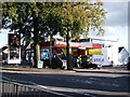
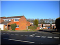
6 photos from this area
Area Information
Key information about the CV10 0JS including its size, population, and administrative classification.
- Area Type
- Postcode
- Area Size
- 2.1 hectares
- Population
- 2062
- Population Density
- 2569 people/km²
House Prices in CV10 0JS
57
Properties
£105,824
Average Sold Price
£36,000
Lowest Price
£182,500
Highest Price
Showing 57 properties
| Address | Type | Beds | Baths | Last Sale Price | Last Sale Date | |
|---|---|---|---|---|---|---|
| 237 Camp Hill Road, Nuneaton, CV10 0JS | house | 2 | 1 | £140,000 | Oct 2025 | |
| 215 Camp Hill Road, Nuneaton, CV10 0JS | Retail | 2 | 2 | £140,000 | Mar 2022 | |
| 235 Camp Hill Road, Nuneaton, CV10 0JS | Semi-detached | 3 | 1 | £182,500 | Jan 2020 | |
| 269 Camp Hill Road, Nuneaton, CV10 0JS | Semi-detached | 2 | 1 | £157,500 | Oct 2019 | |
| 271 Camp Hill Road, Nuneaton, CV10 0JS | Semi-detached | 2 | 1 | £163,000 | Jun 2019 | |
| 251 Camp Hill Road, Nuneaton, CV10 0JS | house | - | - | £110,000 | Oct 2015 | |
| 253 Camp Hill Road, Nuneaton, CV10 0JS | Semi-detached | 3 | 1 | £143,500 | Sep 2015 | |
| 207 Camp Hill Road, Nuneaton, CV10 0JS | Semi-detached | 2 | - | £122,800 | Jul 2015 | |
| 227 Camp Hill Road, Nuneaton, CV10 0JS | Terraced | 2 | - | £107,500 | Nov 2014 | |
| 239 Camp Hill Road, Nuneaton, CV10 0JS | house | 3 | - | £122,500 | Jul 2013 |
Page 1 of 6
Energy Efficiency in CV10 0JS
Amenities
Schools
| Rank | School | Type | Entry gender | Ages |
|---|
Explore more schools in this area
Go to Schools tabDemographics
Household Size
Two person
most common
Accommodation Type
Houses
most common
Tenure
71
majority
Ethnic Group
White
most common
Religion
N/A
most common
Household Composition
N/A
most common
Age
47
median
Adults (30-64 years)
most common
Household Deprivation
N/A
with no deprivation
NS-SEC
24
in Lower managerial occupations
Explore more demographic insights in this area
Go to Demographics tabPlanning
Planning Constraints
- Flood RiskPremium
- Ramsar Wetland SitesPremium
- Area of Outstanding Natural BeautyPremium
- Protected Nature ReservePremium
- Protected WoodlandPremium