Area Overview for CV1 4JB
Photos of CV1 4JB
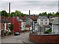
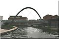

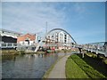
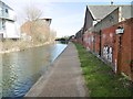


100 photos from this area
Area Information
Key information about the CV1 4JB including its size, population, and administrative classification.
- Area Type
- Postcode
- Area Size
- 1009 m²
- Population
- 1431
- Population Density
- 8704 people/km²
House Prices in CV1 4JB
17
Properties
£151,230
Average Sold Price
£98,500
Lowest Price
£235,000
Highest Price
Showing 17 properties
| Address | Type | Beds | Baths | Last Sale Price | Last Sale Date | |
|---|---|---|---|---|---|---|
| 6, Turbine Hall, Electric Wharf, Coventry, CV1 4JB | Maisonette | - | - | £145,000 | Jul 2023 | |
| 17, Turbine Hall, Electric Wharf, Coventry, CV1 4JB | Flat | - | - | £185,000 | Feb 2022 | |
| 10, Turbine Hall, Electric Wharf, Coventry, CV1 4JB | Flat | 2 | 1 | £230,000 | Jan 2018 | |
| 14, Turbine Hall, Electric Wharf, Coventry, CV1 4JB | Flat | 1 | 1 | £170,000 | May 2017 | |
| 16, Turbine Hall, Electric Wharf, Coventry, CV1 4JB | Flat | - | - | £235,000 | May 2017 | |
| 7, Turbine Hall, Electric Wharf, Coventry, CV1 4JB | Flat | 1 | 1 | £112,000 | Jan 2017 | |
| 8, Turbine Hall, Electric Wharf, Coventry, CV1 4JB | Flat | 2 | 2 | £159,000 | Mar 2016 | |
| 9, Turbine Hall, Electric Wharf, Coventry, CV1 4JB | Flat | 2 | 2 | £177,000 | Apr 2015 | |
| 5, Turbine Hall, Electric Wharf, Coventry, CV1 4JB | Flat | - | - | £99,950 | Feb 2007 | |
| 13, Turbine Hall, Electric Wharf, Coventry, CV1 4JB | Flat | 2 | 2 | £175,000 | Mar 2006 |
Page 1 of 2
Energy Efficiency in CV1 4JB
Amenities
Schools
| Rank | School | Type | Entry gender | Ages |
|---|
Explore more schools in this area
Go to Schools tabDemographics
Household Size
Family (3-5 people)
most common
Accommodation Type
Houses
most common
Tenure
30
majority
Ethnic Group
asian_total
most common
Religion
N/A
most common
Household Composition
N/A
most common
Age
47
median
Adults (30-64 years)
most common
Household Deprivation
N/A
with no deprivation
NS-SEC
17
in Lower managerial occupations
Explore more demographic insights in this area
Go to Demographics tabPlanning
Planning Constraints
- Flood RiskPremium
- Ramsar Wetland SitesPremium
- Area of Outstanding Natural BeautyPremium
- Protected Nature ReservePremium
- Protected WoodlandPremium