Area Overview for CV1 2SU
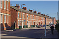
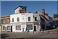
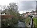
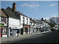
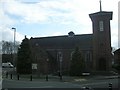
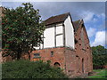
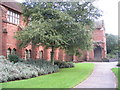
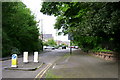
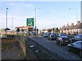
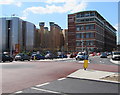
Photos of CV1 2SU

Area Information
CV1 2SU is a compact residential postcode in England, covering 3,449 square metres and home to 1,922 residents. Its small size means it is a tightly knit area, with a high population density of 557,300 people per square kilometre. This postcode is part of a broader urban fabric near Coventry, where daily life is shaped by proximity to amenities and transport links. The area’s character is defined by its youthful demographic, with a median age of 22 and the majority of residents aged 15–29. This suggests a community of students, young professionals, or families with children, likely drawn to nearby schools and connectivity. While the area lacks detailed historical or cultural context in official records, its practical advantages—such as rail access and retail options—make it a functional choice for those prioritising convenience over heritage. Living here means navigating a high-density environment with limited green space, but with access to essential services within walking or cycling distance.
- Area Type
- Postcode
- Area Size
- 3449 m²
- Population
- 1922
- Population Density
- 6709 people/km²
The property market in CV1 2SU is dominated by rental properties, with only 11% of homes owned by residents. This suggests a strong tenant-driven market, likely influenced by the area’s youthful demographic and proximity to educational or employment centres. The primary accommodation type is houses, though the small area size and high density indicate these are likely compact, possibly terraced or semi-detached units. For buyers, this presents limited opportunities, as the area is not a traditional owner-occupied zone. Prospective purchasers may find competition fierce, with demand outpacing supply. The focus on rental housing also means property values may be lower compared to nearby areas with higher ownership rates. Those considering purchase should weigh the potential for long-term stability against the current transient nature of the community.
House Prices in CV1 2SU
No properties found in this postcode.
Energy Efficiency in CV1 2SU
Residents of CV1 2SU have access to a range of amenities within walking or short driving distance. Retail options include major chains like Sainsburys Coventry, Co-op Coventry, and Spar, providing everyday shopping convenience. The area’s rail network connects to multiple stations, offering easy access to Coventry’s urban centres and beyond. The presence of two airports, both named Coventry Airport, suggests proximity to regional travel hubs, though details on their operational status or services are not provided. While the area lacks detailed information on parks or leisure facilities, the high density of retail and transport options indicates a practical, service-oriented lifestyle. This makes CV1 2SU suitable for those prioritising accessibility over expansive recreational spaces, with a focus on convenience and connectivity.
Amenities
Schools
Residents of CV1 2SU have access to several primary schools, including Southfields Primary School and St Mary’s Catholic Primary School. Both are primary institutions, with Southfields Primary School holding a ‘good’ Ofsted rating. The area also includes Summit School, a special needs institution. This mix of school types caters to a range of educational needs, from general primary education to specialist support for students with additional requirements. The presence of two primary schools within proximity suggests a focus on early education, which may appeal to families with young children. However, the absence of secondary schools or higher education institutions in the immediate area means parents may need to look further afield for secondary schooling. The ‘good’ rating at Southfields Primary School indicates a reliable option for local families, though the overall school landscape is limited in scope.
| Rank | School | Type | Entry gender | Ages |
|---|
Explore more schools in this area
Go to Schools tabDemographics
The population of CV1 2SU is overwhelmingly young, with a median age of 22 and the most common age range being 15–29 years. This reflects a community skewed towards students, young workers, or families with children. Home ownership is exceptionally low at 11%, indicating that the majority of residents are renters, likely in shared or purpose-built housing. The primary accommodation type is houses, though the small area size and high density suggest these are likely terraced or semi-detached properties. The predominant ethnic group is White, with no specific data on other demographics provided. The low home ownership rate and youthful profile imply a transient population, possibly linked to student or temporary employment hubs. This dynamic community may lack the stability of longer-term residents but offers a lively, ever-changing social environment.
Household Size
Accommodation Type
Tenure
Ethnic Group
Religion
Household Composition
Age
Household Deprivation
NS-SEC
Explore more demographic insights in this area
Go to Demographics tabPlanning
Planning Constraints
- Flood RiskPremium
- Ramsar Wetland SitesPremium
- Area of Outstanding Natural BeautyPremium
- Protected Nature ReservePremium
- Protected WoodlandPremium